NESP-MaC-3.17-Datastory-marine-chart.jpeg
Image
Licence

Description
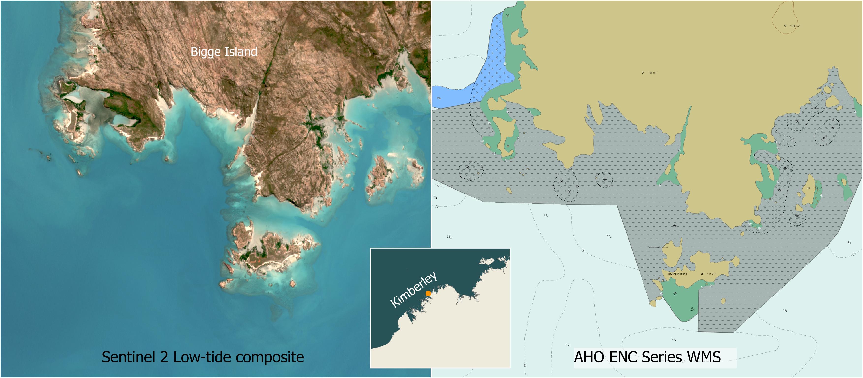
The satellite imagery can be used to better understand the reefs that exist in uncharted regions. In this example we can see that Bigge Island is fringed by coral reefs. These reefs occur in the uncharted region (grey region with dashes) of the AHO ENC Marine Charts (Jun 2025).