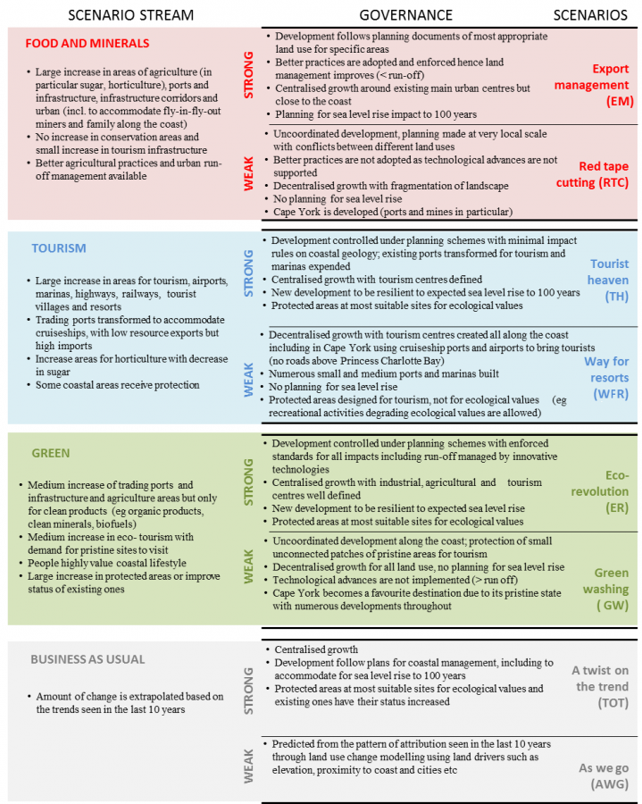
GBR coastal zone 2035 landuse scenario summaries

©
Description
This image summarises the scenarios used to model the future landuse of the coastal zone neighbouring the Great Barrier Reef in 2035. These scenarios can be viewed as an interactive map. See the dataset page Spatial scenarios of future land use to 2035 for the GBR coastal zone for information about this modelling and it associated data.
Image produced for the project


