Media for project "NERP TE Project 8.1 - Monitoring the ecological effects of GBR zoning plan on mid and outer shelf reefs (AIMS)"
This page contains all media associated with this project. For more information about the project and its datasets please go to the project metadata record https://eatlas.org.au/data/uuid/2cf689a9-2f4e-4658-b838-9bdca45919ea.
Images
Articles
Published on
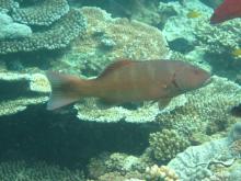
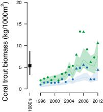
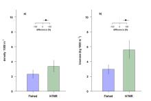
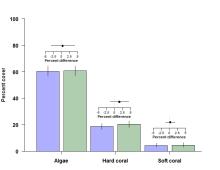
No-take marine reserves (NTMRs) are widely advocated for conserving exploited fish stocks and biodiversity.
Published on
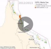
This animation shows the locations of Crown of Thorns Starfish (COTS) outbreaks as measured over the last 30 years.