NESP TWQ Round 1 - Project 3.13 - eAtlas 2015 - NESP data management, Torres Strait NRM plan delivery platform and Torres Strait reef mapping
This project covered the activities of the eAtlas in 2015 (July - December). These were:
- Finishing the publication of NERP TE datasets on the eAtlas.
- Work with 1st round NESP TWQ projects to capture any new relevant data products for inclusion in the eAtlas and provide training sessions on providing data in the right format.
- To support and continue training sessions on the Torres Strait eAtlas with Torres Strait Regional Authority (TSRA) so the Torres Strait eAtlas could be used as a publishing platform for their new Land and Sea Strategy NRM plans.
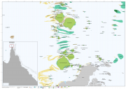
- Work with TSRA to complete the Torres Strait reef mapping, started under the NERP TE, so that it can be used by GBRMPA to process the Torres Strait coral monitoring data (RHIS).
Datasets

This project involves preparing, publishing, and visualizing approximately 50 recently submitted datasets, making them available through the eAtlas and the AODN.
This proposal covers the activities of the eAtlas in 2015 (July - December). These are:

This dataset consists of a shapefile of the reefs, islands, sand banks, cays and rocks of the whole Great Barrier Reef (GBR) including Torres Strait. This dataset is an extension of the mapping in the GBR Marine Park to include Torres Strait. The Torres Strait region was mapped at a scale of 1:50,000 (Lawrey, E. P., Stewart M., 2016) and these new features are referred to as the "Torres Strait Reef and Island Features" dataset.


