Datasets for: NESP TWQ Round 2 - Project 2.1.4 - Demonstration and evaluation of gully remediation on downstream water quality and agricultural production in GBR rangelands
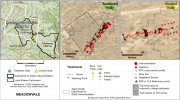
This dataset contains RTK GPS Data collected between April, 2017 and March, 2018 for 5 paired Control/Treatment gully sites being monitored as part of NESP Project 2.1.4 (Demonstration and evaluation of gully remediation on downstream water quality and agricultural production in GBR rangelands). The key question being asked is “is there measurable improvement in the erosion and water quality leaving remediated gully sites compared to sites left untreated?” The monitoring approach uses a modified BACI (Before after control impact) design.
An updated version of this dataset is available at https://eatlas.org.au/data/uuid/38b496a3-3fba-42e7-b904-902f68040c85
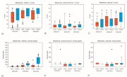
This dataset contains Vegetation and Biomass monitoring data collected for the NESP Project 2.1.4 (Demonstration and evaluation of gully remediation on downstream water quality and agricultural production in GBR rangelands). The aim of the vegetation monitoring in relation to this project is to track change in biomass and species composition over time on hillslope areas above gully erosion within control and treatment sites (treatments vary), linking to changes in downstream water quality.
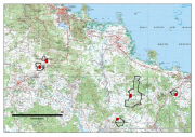
Five paired Control/Treatment gully sites on commercial grazing properties in the Upper Burdekin and Bowen catchments are being monitored as part of NESP Project 2.1.4 (Demonstration and evaluation of gully remediation on downstream water quality and agricultural production in GBR rangelands) (Bartley et al., 2018).
The key question being asked is: "Is there measurable improvement in the erosion and water quality leaving remediated gully sites compared to sites left untreated?" The monitoring approach uses a modified BACI (Before after control impact) design.
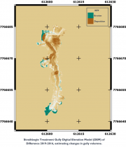
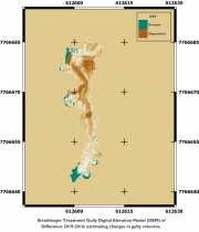
This dataset contains Riegl terrestrial laser scanner scans and their derived 5 cm gridded digital elevation models (DEMs) collected for up to 4 years between 2016 and 2019 for 4 paired Control/Treatment gully sites being monitored as part of NESP Project 2.1.4. Data collection also contains the DEMs of difference used to estimate changes in gully volume.
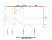
This dataset contains preliminary estimates of discharge and loads (Total suspended sediment and total nitrogen) based on monitoring data collected for the NESP Project 2.1.4 Demonstration and evaluation of gully remediation on downstream water quality and agricultural production in GBR rangelands.
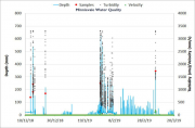
This dataset contains Water Quality monitoring data collected at the project gully sites for the three reporting wet seasons 2016-2017, 2017-2018 and 2018-2019.
The data in presented in this metadata are part of a larger collection and are intended to be viewed in the context of the project. For further information on the project, view the parent metadata record: Demonstration and evaluation of gully remediation on downstream water quality and agricultural production in GBR rangelands (NESP TWQ 2.1.4, CSIRO).


