Description
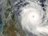
Cyclone Yasi, Category 5
This image was taken by the MODIS sensor on NASA's Aqua Satellite on the 3rd Feb 2011, approximately 10 - 11 am in the morning. This image was sourced from the NASA rapid response subsets site.
 eAtlas (Australian Institute of Marine Science), NASA MODIS Imagery
Severe Tropical Cyclone Yasi crossed the Queensland coast near Mission Beach on the night of the 2nd February 2011. This page shows satellite images (from NASA's MODIS satellites) of the disturbance to the Great Barrier Reef, damage to the vegetation in Mission beach and Cardwell area and flood plumes along the North Queensland coast.
 eAtlas (Australian Institute of Marine Science)
Description
Satellite images (NASA MODIS) of the Mission beach to Cardwell area before and after cyclone Yasi. Click the image for a high resolution version.
North Queensland Maps
Click on the maps to see a high resolution version.
 eAtlas (Australian Institute of Marine Science), NASA MODIS Imagery
Description
North Queensland coast, Great Barrier Reef and Coral Sea during the dry season in 2010.
 eAtlas (Australian Institute of Marine Science), Dr Eric Lawrey (eAtlas (Australian Institute of Marine Science)), NASA MODIS Imagery
Description
5 days prior to Cyclone Yasi crossing the coast. This image is good reference for what the region looked like just prior to the cyclone.
 eAtlas (Australian Institute of Marine Science), Dr Eric Lawrey (eAtlas (Australian Institute of Marine Science)), NASA MODIS Imagery
Description
Cyclone Yasi approaching the coast. This image shows Yasi along with its path (from the BOM).
 eAtlas (Australian Institute of Marine Science), Dr Eric Lawrey (eAtlas (Australian Institute of Marine Science)), NASA MODIS Imagery
Description
2.5 days after Cyclone Yasi crossed the coast. Note the huge disturbance in the Coral Sea and Great Barrier Reef, the flood plumes and the coastal tree damage between Tully and Cardwell.
 eAtlas (Australian Institute of Marine Science), NASA MODIS Imagery
Description
10 days after Cyclone Yasi crossed the coast.
You can download the data, imagery behind the maps in this article.
Related content