Location of recreational use

Description
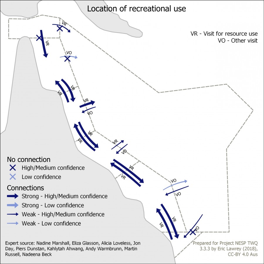
This map shows the connectivity of Location of recreational use in the Great Barrier Reef and its surrounding areas: Torres Strait, Coral Sea and Great Sandy regions. The arrows indicate the strength and nature of the connection between the regions. This map is intended to identify where one region is dependent on a neighbouring region.
Additional notes: Examples: Torres Strait to Coral Sea for charter fishing and GBR Mackay/Capricorn to Coral Sea from cruise ships. Arrows going towards the coast are due to international boats travelling through the Coral Sea to the Queensland Ports. For additional Coral Sea and North Australia content please reference: Expert source: Parks Australia staff - Andy Warmbrunn, Martin Russell, Nadeena Beck. Supporting data: submissions to Australian Marine Park Management plan consultation.
The data for this map was developed based on expert opinion (Nadine Marshall, Eliza Glasson, Alicia Loveless, Jon Day, Piers Dunstan, Kahlytah Ahwang, Andy Warmbrunn, Martin Russell, Nadeena Beck).


