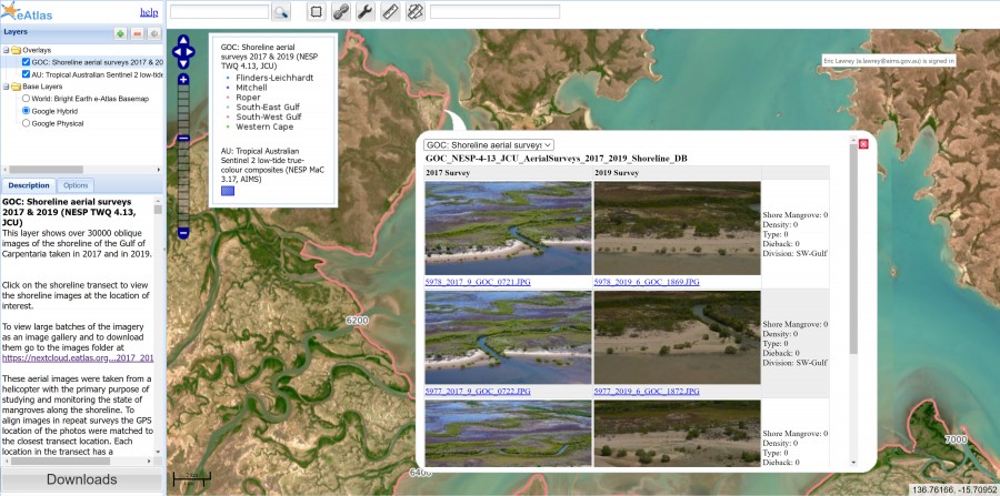
Interactive map of the aerial shoreline imagery.

Description
You can view the shoreline imagery of the Gulf of Carpentaria via an interactive map. Each location, shown as dots on the map, corresponds to an image of the shore. Clicking on the map shows the imagery at that location. Clicking on the thumbnails in the popup shows the images full screen. The popup shows the images for all the locations within several pixels around where you click on the map. This means if you are zoomed out, you will see multiple images along the shore, but when zoomed in, you will only see images from individual locations. This view allows you to quickly preview specific locations but is not ideal for browsing a large sequence of images for analysing a section of the coastline. For that, you are better off using the gallery view.


