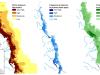
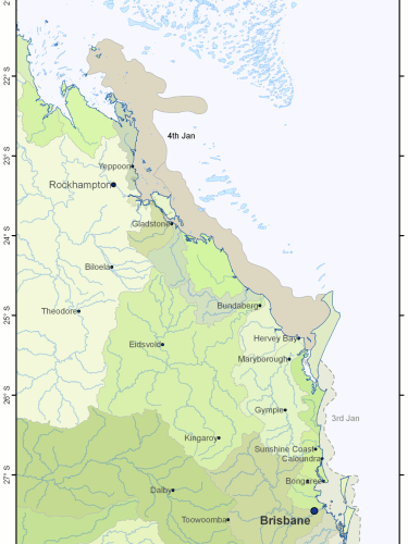
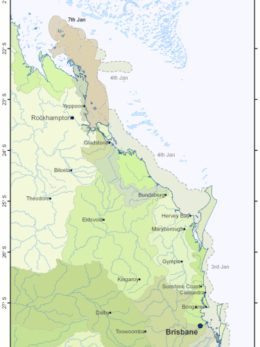
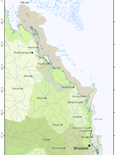
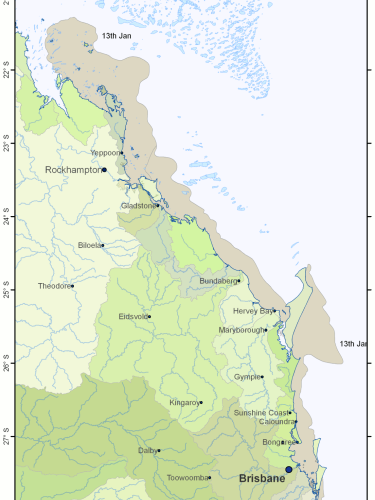
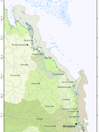
This page shows the extent of the flood plumes of the Fitzroy, Burnett, Mary and Brisbane Rivers caused by the extensive flooding that occurred in Queensland in December 2010 and January 2011. These flood plume maps were produced as part of the Reef Rescue Marine Monitoring Program - Assessment of terrestrial run-off entering the Great Barrier Reef project by James Cook University (contact Michelle Devlin). They were based on visual inspection of NASA MODIS satellite images and were created for days where the cloud cover was low enough to see the boundary of the plumes.
Description
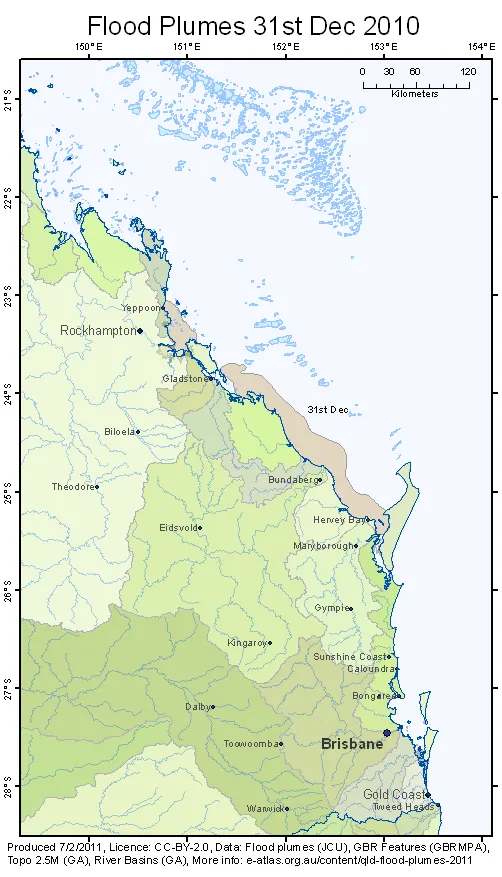
Animation of the progression of the flood plumes on the Great Barrier Reef caused by heavy rain and flooding in the Queensland in December 2010 and January 2011. This map shows the flood plume from the Brisbane River spreading into Moreton Bay then to the tip of Frasier Island. Flood plumes from the Fitzroy river, the Burnett river and the Mary river travel northward into the Great Barrier Reef.
Individual Flood Plume Maps
The following maps correspond to each of the frames in the animation above. Click on the enlarge button on the bottom right corner of the preview image to get a high resolution image version of the map and the link to a PDF version.
Description
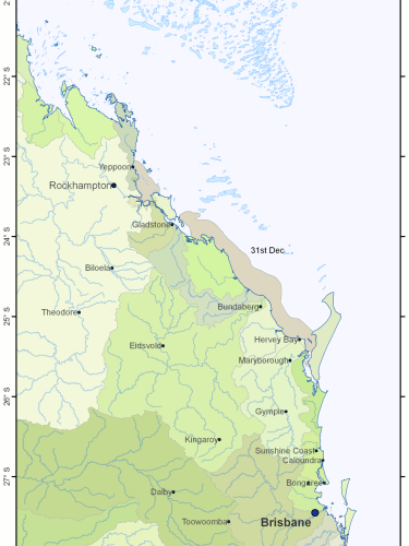
Flood plume from the Fitzroy, Burnett, Mary and Brisbane Rivers in Queensland for 31-dec-2010
See also: QLD Flood Plumes 2010-12-31 (PDF)
Description
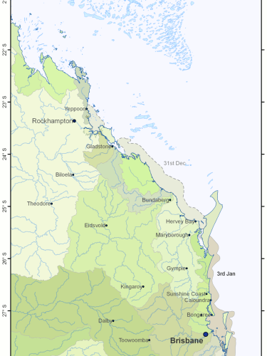
Flood plume from the Fitzroy, Burnett, Mary and Brisbane Rivers in Queensland for 3-jan-2011
See also: QLD Flood Plumes 2011-01-03 (PDF)
Description
Flood plume from the Fitzroy, Burnett, Mary and Brisbane Rivers in Queensland for 4-Jan-2011
See also: QLD Flood Plumes 2011-01-04 (PDF)
Description
Flood plume from the Fitzroy, Burnett, Mary and Brisbane Rivers in Queensland for 7-Jan-2011
See also: QLD Flood Plumes 2011-01-07 (PDF)
Description
Flood plume from the Fitzroy, Burnett, Mary and Brisbane Rivers in Queensland for 11-Jan-2011
See also: QLD Flood Plumes 2011-01-11 (PDF)
Description
Flood plume from the Fitzroy, Burnett, Mary and Brisbane Rivers in Queensland for 13-Jan-2011
See also: QLD Flood Plumes 2011-01-13 (PDF)
Description
Flood plume from the Fitzroy, Burnett, Mary and Brisbane Rivers in Queensland for 18-Jan-2011
See also: QLD Flood Plumes 2011-01-18 (PDF)
Rainfall
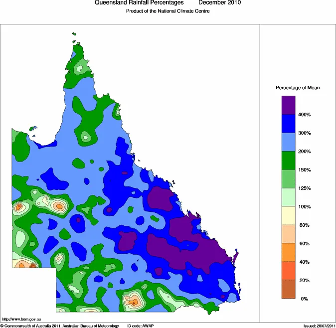
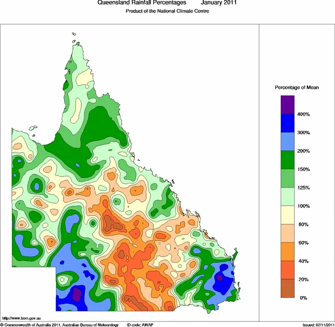
The following maps from the Bureau of Meteorology of Australia show the monthly rainfall for December 2010 and January 2011 that caused much of the flooding. For current conditions, see Monthly rainfall percentages for Queensland (BOM).
Description
Queensland Rainfall for December 2010
Description
Queensland Rainfall for January 2011
Attachments
- Documentqld-flood-plumes-2010-12-31.pdf (265.63 KB)
- Documentqld-flood-plumes-2011-01-03.pdf (270.6 KB)
- Documentqld-flood-plumes-2011-01-04.pdf (275.42 KB)
- Documentqld-flood-plumes-2011-01-07.pdf (282.29 KB)
- Documentqld-flood-plumes-2011-01-11.pdf (275.94 KB)
- Documentqld-flood-plumes-2011-01-13.pdf (274.74 KB)
- Documentqld-flood-plumes-2011-01-18.pdf (277.63 KB)
Related content