Coral Sea Mapping Project (2021-2022)
This 12 month project will develop a set of high quality GIS datasets of the emergent and shallow features (reef boundaries, reef tops, islands, and cays) of the Coral Sea Marine Park (CSMP), which with a coverage of more than 989,000 square kilometres, is one of the world’s largest marine parks.
This project will map these features in a manner similar to the existing reef mapping of the Great Barrier Reef Marine Park (GBRMP) and Torres Strait (Lawrey, et al. 2016). This will include mapping the visible extent of the coral atoll patforms, reef boundaries, reef tops, cays, beach rock and vegetation. The atolls, reefs and cays will be assigned unique identifiers and existing names of these features, based on historic maps and nautical charts, will be incorporated into the dataset.
Satellite imagery derived from the Sentinel 2 and Landsat 8 satellites will be used as the based on the reef boundary mapping. Some cay areas will be mapped from drone mosaics collected by Parks Australia. The satellite imagery will be converted to cloud free composite images using the Google Earth Engine. The imagery along with the processing scripts and mapped features will be published openly.
This project is co-funded by Parks Australia and the Australian Institute of Marine Science.
Project Resources
This project will follow open science principles, recording and releasing project work in near real time. These will be available from the project resources and files site (presentations), videos will be published in a Youtube project playlist and linked to from this project page.
Datasets

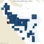
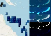
This dataset contains Sentinel 2 and Landsat 8 cloud free composite satellite images of the Coral Sea reef areas and some parts of the Great Barrier Reef. It also contains raw depth contours derived from the satellite imagery. This dataset was developed as the base information for mapping the boundaries of reefs and coral cays in the Coral Sea. It is likely that the satellite imagery is useful for numerous other applications. The full source code is available and can be used to apply these techniques to other locations.

This dataset contains composite satellite images for the Coral Sea region based on 10 m resolution Sentinel 2 imagery from 2015 – 2021. This image collection is intended to allow mapping of the reef and island features of the Coral Sea. This is a draft version of the dataset prepared from approximately 60% of the available Sentinel 2 image. An improved version of this dataset was released https://doi.org/10.26274/NH77-ZW79.
This project developed a set of high quality GIS datasets of the emergent and shallow marine features (reef boundaries, reef tops, islands, and cays) of the Coral Sea Marine Park (CSMP). The goal of this mapping was to improve the precision and spatial detail of existing reef maps.


