Torres Strait Islands and Reefs Map (Poster)
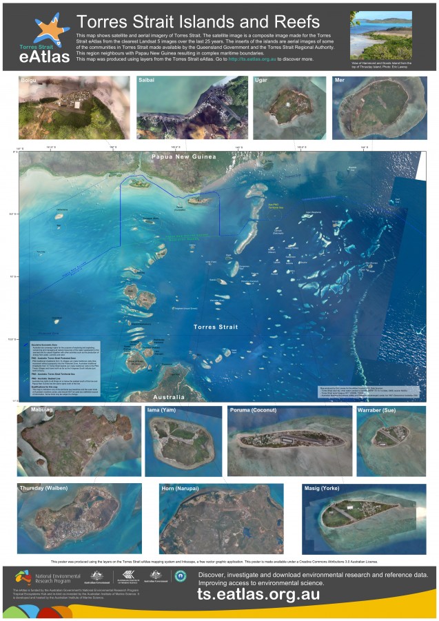
This poster map shows satellite and aerial imagery of 11 of the populated islands (Boigu, Saibai, Ugar, Mer, Mabuiag, Iama (Yam), Poruma (Coconut), Warraber (Sue), Thrusday (Waiben), Horn (Narupai) and Masig (York)) of Torres Strait. It also shows the Australia Maritime Boundariers in the region. This region neighbours with Papau New Guinea resulting in complex maritime boundaries.
The satellite image is a composite image made for the Torres Strait eAtlas from the clearest Landsat 5 images over the last 25 years. The inserts of the islands are aerial images of some of the communities in Torres Strait made available by the Queensland Government and the Torres Strait Regional Authority.
This map shows that the Great Barrier Reef extends northward past the tip of Cape York (the northern boundary of the Great Barrier Reef Marine Park). In Torres Strait there are over 680 reefs (Lawrey & Stewart 2016), many of which are visible in this poster.
This map was produced using layers from the Torres Strait eAtlas.
This map is available as an interactive map and you can download the original basemap map satellite image.
This poster was developed for the National Environmental Research Program (NERP) and is made available under a Creative Commons Attributions 3.0 Australian License.
References
Lawrey, E. P., and Stewart, M. (2016) Mapping the Torres Strait Reef and Island Features: Extending the GBR Features (GBRMPA) dataset. Report to the National Environmental Science Programme. Reef and Rainforest Research Centre Limited, Cairns (103pp.).


