
Green turtles
Image
Licence
Download original image
 Dr Eric Lawrey (eAtlas (Australian Institute of Marine Science)), NESP TWQ 3.3.3, Mark Hamann
Dr Eric Lawrey (eAtlas (Australian Institute of Marine Science)), NESP TWQ 3.3.3, Mark Hamann
Description
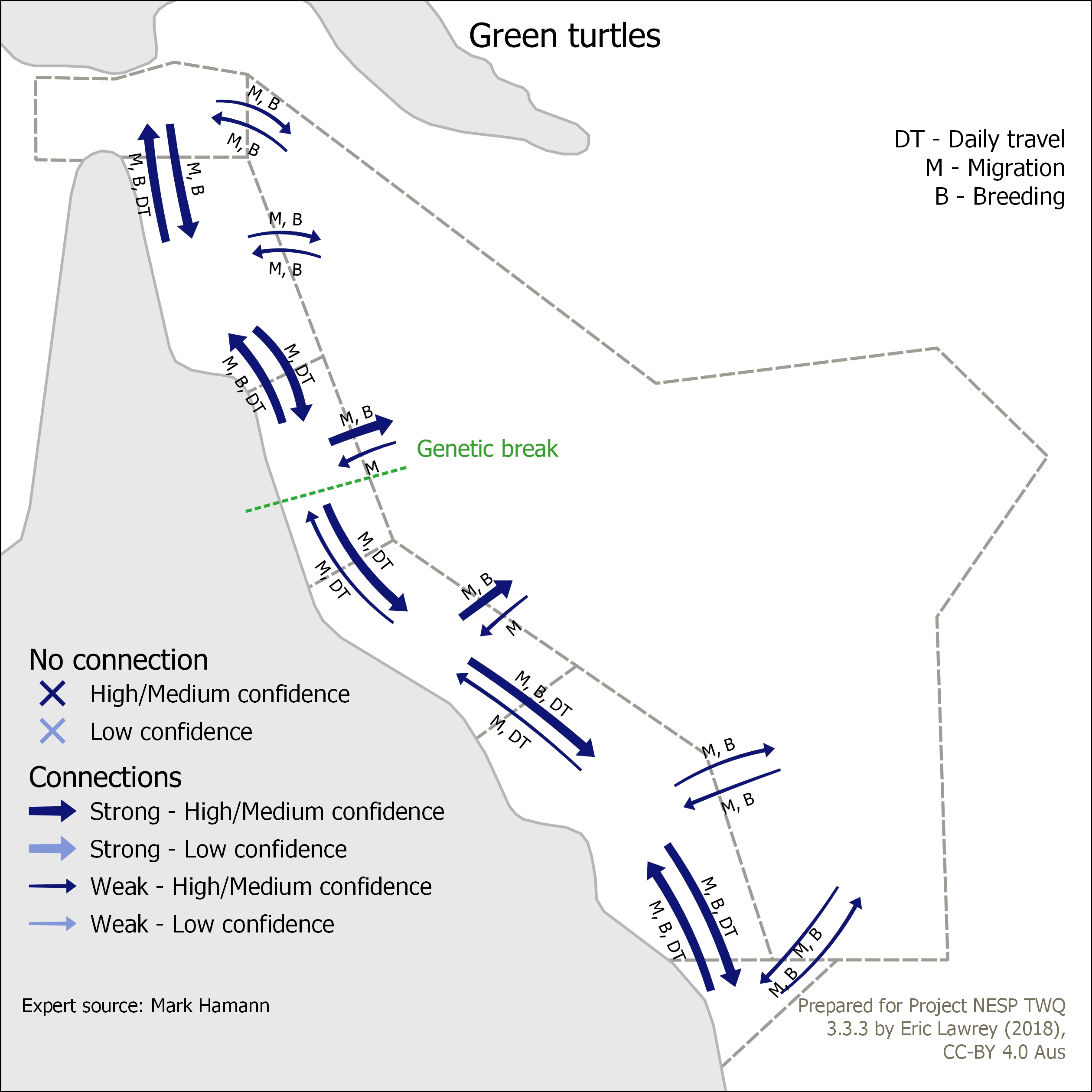
This map shows the connectivity of Green turtles in the Great Barrier Reef and its surrounding areas: Torres Strait, Coral Sea and Great Sandy regions. The arrows indicate the strength and nature of the connection between the regions. This map is intended to identify where one region is dependent on a neighbouring region.
Additional notes: All movements for migration. Turtles live in foraging areas 90% of time.
The data for this map was developed based on expert opinion (Mark Hamann).