Recent datasets

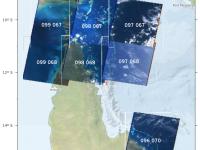
Landsat 5 Satellite Imagery for selected areas of Great Barrier Reef and Torres Strait (NERP TE 13.1, eAtlas AIMS, source: NASA)

Published on
20 August 2014

This dataset contains Landsat 5 imagery for selected areas of Queensland, currently Torres Strait and around Lizard Island and Cape Tribulation. This collection was made as a result of the development of the Torres Strait Features dataset. It includes a number (typically 4 - 8) of selected Landsat images for each scene from the entire Landsat 5 archive. These images were selected for having low cloud cover and clear water. The aim of this collection was to allow investigation of the marine features.

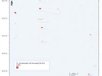
Warraberalgahl and Porumalgal Indigenous Protected Area (IPA) 2014 (TSRA)

Published on
18 July 2014

This dataset shows the location and size of the 9 islands, cays and rocks that make up the Warraberalgahl and Porumalgal Indigenous Protected Area (IPA). The IPA is recognised as part of the National Reserve System and was officially declared on the 18/07/2014. The declared area covers approximately 63 hectares. The following Islands, Cays and Rocks make up the IPA: Atub, Bara, Bini, Babui, Guiya, Maza Guiya, Miggi Maituin, Ugain and Ulu. GPS coordinates were used to identify the islands using Google Earth and polygons were manually drawn over this imagery to create the dataset.

Persistence of glyphosate in seawater. Glyphosate concentrations recorded over time in standard flask experiment 2013. (NERP TE 4.2, AIMS and UQ)

Published on
28 May 2014

This dataset shows the concentrations of the herbicide glyphosate remaining over time in a simulation flask persistence experiment conducted in 2013. Glyphosate degradation experiments were carried out in flasks according to the OECD methods for ‘‘simulation tests’’. The tests used natural coastal seawater and were carried out in the incubator shakers under 3 conditions: (1) 25°C in the dark, (2) 31°C in the dark and (3) 25°C in the light. The light levels were ~40 µE on a 12:12 light:dark cycle and the flasks shaken at 100 rpm for up to 330 days.

Torres Strait Coastal Hazard Mapping 2014 - High resolution coastal digital elevation model from LiDAR and island storm surge and highest astronomical tide thresholds (TSRA)

Published on
13 March 2014

This dataset contains a series of high resolution raster Digital Elevation Models (DEM) (1m resolution) around the coastal perimeter of Torres Strait community islands (Badu, Boigu, Dauan, Erub, Hammond, Iama, Mabuiag, Masig, Mer, Moa, Poruma, Saibai, Ugar, Warraber). This dataset was developed for the purpose of mapping levels of coastal inundation under different sea level rise and storm tide scenarios.

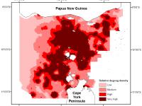
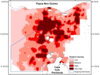
Torres Strait Dugong distribution and relative density - Spatial model of aerial surveys from 1987 - 2011 (NERP TE 2.1, JCU)

Published on
02 August 2011

This dataset shows a raster spatial model of the distribution and relative density of dugongs (Dugong dugong) in the Torres Strait region based on an aggregate of 24 years (1987 - 2011) of systematic aerial surveys. Aerial surveys were conducted using the strip transect method described by Marsh and Sinclair (1989). The survey region was divided into blocks containing systematic transects of varying length, which were typically perpendicular to the coast across the depth gradient.