
Articles
Published on
Image
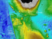
A collaborative research voyage on the state-of the-art research vessel RV Investigator in 2018 explored Tasmania’s hidden seamounts (under-sea mountains). Extensive areas of deep-sea coral reefs supporting diverse communities were surveyed, mostly between 700 and 1500 metres below the sea surface. These seamount reefs represent a globally significant reference site to monitor recovery of deep-sea coral communities following the impacts sustained from bottom trawling in the 1990’s.
Published on
Image
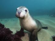
The Great Australian Bight is one of the last strongholds of the charismatic Australian sea lion. Every year, researchers overcome the challenges of sheer cliffs and isolated rocky islands to count new pups, information that provides critical insights into how this threatened species is faring and how marine park managers can address existing and emerging threats.
Published on
Image
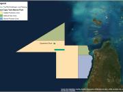
Acoustic mapping of one of northern Australia’s least studied coral shoals and searching for a shipwreck.
Published on
Image
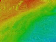
Scientists have captured imagery of a newly discovered underwater landscape beneath the waves in Bass Strait, revealing a complex seabed of deep reefs that have been sustaining life for fish and other fauna for millennia. Using multibeam sonar, a team from Deakin University’s marine mapping group has scanned the seafloor in the Apollo Marine Park, south-west Victoria for the very first time.
Published on
Image
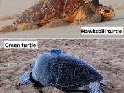
Global populations of green (IUCN listing endangered) and hawksbill (IUCN listing critically endangered) turtles are declining due to a range of threats. Australia supports some of the largest rookeries (nesting sites) for these turtles in the Indo-Pacific. Even though they've been much studied, most data that shows where these turtles spend their time around Australia remains unpublished. Here, we set out to quantify and map the important areas that turtles use to help refine these protected areas and assist with turtle conservation management.
Published on
Image
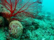
The Silver Lipped Oyster, Pinctada maxima, forms the basis of a historical fishery in tropical Western Australia, estimated to be worth $A61 million in 2013. This fishery supplies pearl and mother of pearl markets through wild harvest of P. maxima stock, augmented more recently with aquaculture. Studies have shown that populations of P. maxima within the region are highly connected to one another. This raises the question of whether oysters located deeper than those safely visited by divers (beyond 30-40 metres) may help replenish stocks in shallower areas. At present, the extent to which P.
Published on
Image
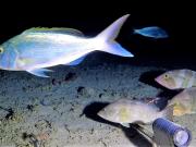
The North West Shoals to Shore Research Program investigated seabed habitats and their biodiversity to inform management and sustainable development of the region. Little is known about the fish found on and around the AC125. Part of the reason is that the AC125 is very deep, and thus difficult to observe. One question to ask about a habitat is how many different species of fish are found there - this is called fish species 'richness'. We explored this question for 5 study areas spread along the vast AC125 (see map below, read the full paper here).
Published on
Image
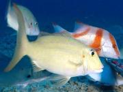
Little is known about what fish species call the AC125 home. Part of the reason is that the AC125 is very deep, and thus difficult to observe. To fill this gap, we conducted fish relative abundance and diversity surveys across five study Areas of the AC125 using Baited Remote Underwater Video Stations (BRUVS). BRUVS were deployed on and off the AC125 at a minimum distance of 500 m between each unit. A total of 204 BRUVS deployments were conducted at depths between 62.1 m and 181.4 m across each study Area from the RV Solander.
Published on
Image
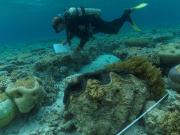
A re-survey of sites within the North-west Marine Park Network revealed an increase in fish biomass, richness, biomass of larger fishes, coral cover and macro-invertebrate density at Ashmore Reef Marine Park (IUCN Ia). Many of these changes were not recorded at fished reference sites, suggesting the strict sanctuary zoning is having a positive effect.
Published on
Image
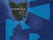
In Autumn 2019, the Institute of Marine and Antarctic Science (IMAS) completed a two-week continuous multibeam mapping program in shelf waters of the Freycinet, Huon and Tasman Fracture Marine Parks to extend current knowledge of habitat distribution in these parks. In addition, several areas outside the park were mapped to provide external reference areas for the Tasman Fracture Marine Park. This mapping will underpin future biological inventory and monitoring programs.
Published on
Image
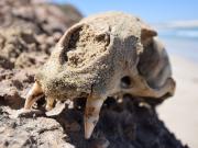
Fowlers Bay sits in the Great Australian Bight, immediately adjacent to the Great Australian Bight Marine Park. The bay is characterised by long stretches of wide, white sandy beaches and rocky headlands. To the east, they’re backed by towering sand dunes and to the west, immense 90 metre cliffs run for a 170 kilometre stretch. Exposed to south-easterly winds that drive large swells, the region is a popular haunt for the keen surfer and recreational fisherman. It is also known for its white shark population and thought to be prime habitat for juvenile white sharks.
Published on
Image
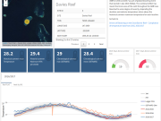
Over the last fifteen years a number of major efforts have significantly expanded the sustained monitoring of the Great Barrier Reef (GBR).
Published on
Image
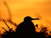
At the very edge of continental Australia lies a biological powerhouse. Isolated by hundreds of kilometres of ocean and visible only by a few tiny specks of land, Ashmore Reef is a unique place with a globally important role to play. A visionary scientific partnership, mixing new and old survey methods, is now delivering the data and insight Parks Australia needs to improve management of this ocean oasis.
Published on
Image
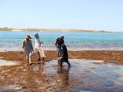
Understanding the management and governance of Australia’s vast coastline can be complex.
Published on
Image
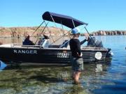
Bardi-Jawi Marine Rangers partner with marine scientists to research fish and coral recruitment processes in the Kimberley.
Published on
Image
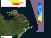
Acoustic mapping of the seafloor off the east coast of East Arnhem Land.
Published on
Image
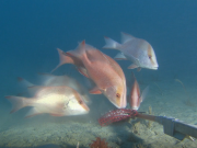
Baited remote underwater stereo-videos (stereo-BRUV) were deployed to gather vital biodiversity benchmark data from some of the deepest parts of Ningaloo Reef.
Published on
Image
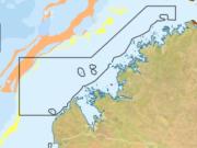
During a recent voyage in the Kimberley Marine Park we discovered fields of benthic siphonophores on the sea floor – one of the first records of this group in Australia.
Published on
Image
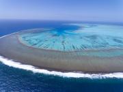
Reef communities remain relatively stable, but show signs of warming-related change
Published on
Image
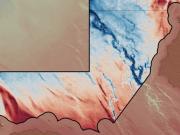
The eco-narrative series synthesises our existing knowledge of Australia's individual Marine Parks to enable managers to understand the ecological characteristics of each park and highlight knowledge gaps for future research focus.