
Articles
Published on
Image
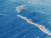
Beagle Marine Park contains an extensive area of soft sediment with some areas of rocky reef, which are likely to be a relict sand dune field prior to sea level rise.
Published on
Image
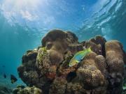
Parks Australia manage 60 Australian Marine Parks, many of which include shallow reefs. These reef habitats are hugely diverse, and include tropical reefs dominated by hard corals; current-swept offshore bommies covered in sea whips, sea fans and soft corals; temperate rocky reefs with sea urchin barrens or low lying colourful seaweeds; and deeper rocky reefs with sessile invertebrates and large black coral trees.
Published on
Image
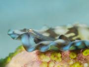
Small and/or camouflaged fish species hidden on or near the reef surface are commonly referred to as ‘cryptic’ or ‘cryptobenthic’ fishes. These species are characteristically difficult to see but are diverse and abundant throughout Australian Marine Parks and may play an important role in supporting the larger predatory fish species protected within park boundaries.
Published on
Image
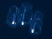
‘Blackwater’ diving uncovers a unique set of marine creatures in the Coral Sea Marine Park. As the moon dips below the horizon, a suite of dark-dwelling species is revealed via torchlight during their nightly migration towards the ocean surface.
Published on
Image
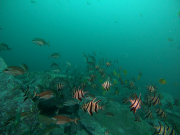
In this project multibeam bathymetry and baited remote underwater videos (Stereo-BRUVs) were used to characterise where reefs occur in the Hunter Marine Park and what lives on them.
Published on
Image
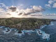
Surveys of shallow reef biodiversity were undertaken in the Norfolk Marine Park (NMP) in 2009, 2013 and 2021 by collaborative dive teams from the Reef Life Survey program and University of Tasmania. While the reef life differed between locations around the Island, relatively little change has occurred over the 13-year study period.
Published on
Image
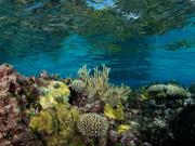
The 2016 and 2020 marine heatwaves each impacted shallow coral reef biodiversity in the Coral Sea Marine Park in very different ways, but the net impacts of both affected reefs in the entire region.
Published on
Image
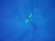
Scientists provide insight into the movements of the Galapagos sharks around Lord Howe Island.
Published on
Image
Mesophotic Coral Ecosystems, which typically exist between 30-150m depth, represent an unexplored but important part of our marine environment. We undertook extensive surveys of the mesophotic zone of Ashmore Reef to better understand the diversity and distribution of marine communities around the reef and help inform future management of this iconic and isolated marine ecosystem.
Published on
Image
We used data from satellite telemetry tags attached to six species of threatened and migratory marine megafauna across three taxonomic groups (marine turtles, whales and sharks) off the coast of north-western Australia to map their areas of use. We then compiled spatial data from a range of threats and overlayed species and threat maps to assess the level of exposure of the species to threats.
Published on
Image
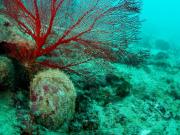
We use genetics to estimate how far and wide oyster larvae can disperse to assist in setting biologically relevant spatial boundaries and harvest limits for oysters.
Published on
Image
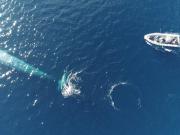
To assist in recovery of the population, spatial areas of importance to pygmy blue whales, known as Biologically Important Areas (BIA), have been identified by the Australian Government. The AIMS team and collaborators Centre for Whale Research and Curtin University set out to reduce uncertainty in identifying where important foraging areas for this species and their migration pathways and distribution exist, and the extent to which they overlap with anthropogenic activities by deploying satellite tags.
Published on
Image
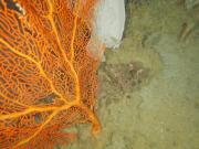
Key Ecological Features (KEFs) are parts of the marine ecosystem considered to be of particular importance for either a region's biodiversity or its ecosystem function and integrity. 13 KEFs have been defined for Australia’s North-west Marine Region, including the ‘Ancient Coastline at 125m depth contour’ (AC125). The AC125 is thought to “provide areas of hard substrate and therefore may provide sites for higher diversity and enhanced species richness relative to surrounding areas of predominantly soft sediment.” Little is known about what habitats exist on the sea floor in the AC125.
Published on
Image
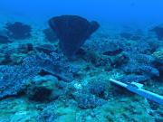
As ocean temperatures continue to rise, a pressing challenge is to increase our understanding of the spatial distribution and characteristics of the critical habitats that support mesophotic reefs and associated demersal fish assemblages. Lord Howe Marine Park in the Tasman Sea protects the southern-most mesophotic coral reefs in the world, including Elizabeth and Middleton Reefs.
Published on
Image
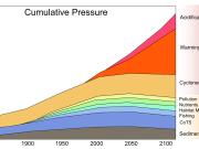
This site provides an introduction to cumulative impacts on coral reefs and outlines some of the latest research into understanding the interactive effects of these impacts and which affect different coral types the most.
Published on
Image
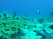
The information in this eco-narrative forms an initial characterisation of the physical, oceanographic and biological character of Arafura Marine Park, with a focus on results from a biodiversity and mapping survey undertaken by the NESP Marine Biodiversity Hub in 2020. This survey targeted two areas (see map below): Money Shoal as an example of shallow coral reef habitat, and Pillar Bank as an example of a deeper water mixed seabed environments. This excerpt focuses mainly on Money Shoal.
Published on
Image
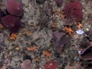
Over the last decade scientists at the Institute of Marine and Antarctic Studies (IMAS) have been using an autonomous underwater vehicle (AUV) to conduct photographic surveys of seafloor (benthic) communities in Australian Marine Parks (AMPs) across the South-east Marine Parks Network (the SE Network). This project used this imagery to provide the first description of the biological communities across these marine parks and how they have changed over time.
Published on
Image
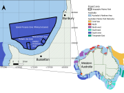
Environmental-economic accounting (EEA) is a powerful tool that enables policy and investment decisions to be made based on whole system analysis which integrates environmental, economic and social data. A pilot accounting project was undertaken for Geographe Marine Park. The EEA examined the location and condition of ecosystems, such as rocky reefs and seagrasses, and the value of ecosystem services, like commercial and recreational fishing and tourism.
Published on
Image
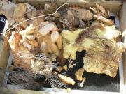
Ningaloo is famed for its corals, but new data has shone a light into the deeper waters and onto its sponge diversity, revealing the region is home to at least 16 new species previously unknown to science.
Published on
Image
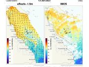
This website displays a collection of tools for getting temperature related information from the GBR.