Articles
Published on
Image
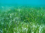
Seagrasses are marine plants found in estuaries, reefs and deep water environments throughout the northeast Australian seascape. They form meadows that provide nutrient-rich habitat for many animals, for example, sea cucumbers, fish, urchins, marine turtles, dugongs, sharks and rays all use seagrass meadows at some time during their life cycle.
Published on
Image
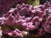
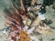
Crustose coralline algae (CCA) are a red macroalgae (seaweed) that accumulate calcium carbonate and generally grow as encrusting, pink-colored, veneers over the reef substrate. While often inconspicuous to the casual observer, CCA play a vital role in the maintenance of many coral reef systems.
Published on
Image
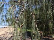
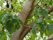
Coastal she-oaks (Casuarina equisetifolia) are an evergreen tree (6 to 20m high) found on coastal sand dunes, beach fronts in sands alongside estuaries and behind fore-dunes, and on gentle lower hills/headlands. Other common names include beach casuarina, beach she-oak or whistling tree.
Published on
Image
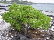
Tree Heliotrope (Heliotropium foertherianum) is a shrub or small tree, typical of littoral zones, 1-5 m tall, with a spread of about 5 m. It is a strand plant of coastal environments, and is often found near the water’s edge, even where waves occasionally wash over its root system or batter its lower trunk or roots. It is capable of growing in saline conditions and in nutrient-poor sands and rocky soils, and often forms the seaward fringe of vegetation.
Published on
Image
Pisonia; or Birdlime Tree (due to the fact that at times nesting birds become covered with the sticky fruits).
Published on
Image
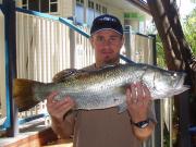
Barramundi is an iconic species throughout northern Australia and are important for all fishing sectors economically, socially and culturally. Catches of barramundi vary spatially and temporally and can be significantly related to river flow or rainfall and evaporation. Variability in catch probably represents changes in underlying stock abundance linked to environmental drivers.
Published on
Image
Find out where the seafloor has been mapped with sonar across the Marine Parks.
Published on
Image

Learn more about biodiversity and why it matters to marine parks
Published on
Image
Find out where 13 marine species have been observed in the Marine Parks of the N and NW networks.
Published on
Image
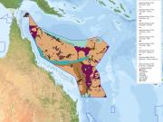
Find out where activities to search for and extract petroleum offshore are planned, underway or cancelled.
Published on
Image
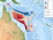
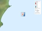
Fine scale bathymetry information is available for the Coral Sea Marine Park
Published on
Image
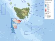
Fine scale bathymetry information is available for the Tasman Fracture Marine Park
Published on
Image
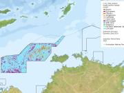
Explore the seafloor features of the Oceanic Shoals Marine Park
Published on
Image
Explore the seafloor features of the Coral Sea Marine Park
Published on
Image
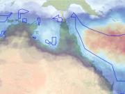
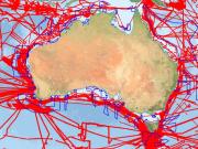
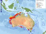
Examine how exposure to tropical cyclone activity varies across Australian Marine Parks.
Published on
Image
Explore the seafloor features of the Leveque Shelf in the Kimberley Marine Park
Published on
Image
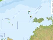
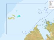
See where the reefs of the Cod Grounds Marine Park, home to the endangered Grey Reef shark, are located
Published on
Image
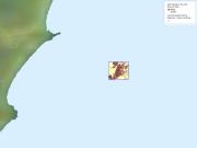
Fine scale bathymetry information is available for the Cod Grounds Marine Park
Published on
Image
Learn more about what lives on the seafloor in the Oceanic Shoals Marine Park: hard and soft corals, sponges, burrowers, algae and seagrass
Published on
Image
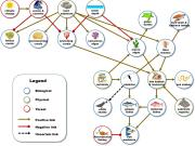
Learn more about the Glomar Shoals KEF, based on new knowledge of its benthic and pelagic environments that researchers within the NESP Marine Biodiversity Hub used to develop a preliminary model of the KEF's ecosystem components and processes.