Articles
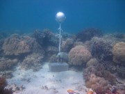
As part of the NERP TE project 2.3 temperature loggers were deployed at 15 sites across the Torres Strait to measure ocean temperature. The loggers regularly (every 10 minutes) measure the sea water temperature and record it in their memory. Every year or so the loggers are swapped with new loggers and the recorded data is extracted and recorded in the AIMS Real Time Data Systems database as part of the Australia wide Sea Temperature Observing System.
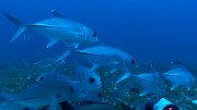

The last decade in north Queensland has seen a striking contrast of summers of below median rainfall (2002-2006) and ‘big wets’ (2007-2012). The run of relatively dry summers, followed by the years of high summer rainfall created perfect conditions for researchers to study the effects of river runoff on water clarity in the Great Barrier Reef (GBR) lagoon.
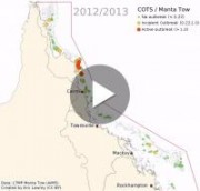
This animation shows the locations of Crown of Thorns Starfish (COTS) outbreaks as measured over the last 30 years.
This animation shows that the COTS outbreaks tend to travel down the coast taking almost 15 years to move from the initiation area north of Cairns to finally reach and dissipate off the reefs offshore from to the Whitsundays.
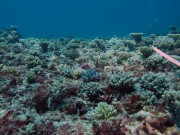
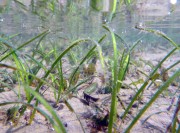
Pesticides from agricultural sources have been detected throughout the year in the Great Barrier Reef World Heritage Area (RRMMP). Australia has strict standards and monitoring to limit the amount of pesticides allowed in food products. However, the fate and impact on the environment of toxic chemicals applied to crops is less well known.
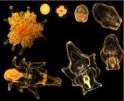
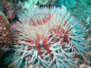
The crown-of-thorns starfish (COTS) (Acanthaster planci) feeds almost exclusively on hard corals and is endemic to coral reef ecosystems throughout the Indo-Pacific (Birkeland 1990). These large starfish are covered in sharp toxic spines and once grown have few natural predators. Over their lifetime they can produce 100’s of millions of eggs that have the highest fertilisation rate recorded for any spawning marine species. The pelagic larvae produced from spawning can float in the water column for weeks before settlement and can easily travel large distances between reefs.
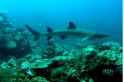
On the Great Barrier Reef sharks are readily identified as fearsome predators. In ecological theory, species that are at the top of the food chain are commonly described as apex predators. However generalising all sharks as apex predators is misleading and may lead to poor outcomes in the context of managing coral reefs and sharks for conservation.
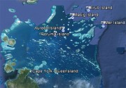
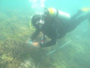
Coral reefs in the coastal and inshore zones of the Great Barrier Reef (GBR) are highly valued for recreation and local tourism, but their proximity to land exposes these reefs to land runoff carrying excess amounts of fine sediments and nutrients from developed catchments. The land management initiatives under the Australian and Queensland Government's Reef Water Quality Protection Plan 2013 (Reef Plan) are key tools to improve the water quality entering the GBR and will, in the long-term, improve the environmental conditions for inshore coral reefs. Long-term monitoring of 32 inshore reefs (Figure 1) is part of the Reef Plan and is fundamental to determine the condition of inshore coral reefs and long-term trends related to Reef Plan’s actions on the catchment.
The condition of coral communities on inshore reefs of the GBR has been in a state of decline in recent years. The ninth MMP inshore coral reef survey completed in 2013 demonstrated the halting and reversal of these declines in all regions with the exception of the Fitzroy Region (Figure 2). Observed declines in coral community composition can be attributed to exposure to extreme weather events, including tropical cyclones and flooding in combination with responses to chronic environmental stress. The return to more moderate levels of runoff in 2013 and a lack of cyclone damage has allowed coral communities to begin to recover. Severe flooding in the Fitzroy Region again in 2013 has ensured the continued very poor condition of corals in that region.
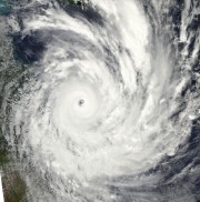
Severe Tropical Cyclone Yasi crossed the Queensland coast near Mission Beach on the night of the 2nd February 2011. This page shows satellite images (from NASA's MODIS satellites) of the disturbance to the Great Barrier Reef, damage to the vegetation in Mission beach and Cardwell area and flood plumes along the North Queensland coast.
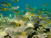
Corals provide essential habitat structure and energy in coral reef systems, facilitating the existence of numerous reef associated species. Indo-Pacific coral reefs are home to over 600 species of hard corals (also called stony corals or scleractinian corals), and 4000-5000 species of reef fishes (Veron 2000, Lieske and Myers 2001). There are strong mutual dependencies between the reef-building corals and reef-inhabiting fishes, with many fish species depending on corals for food and habitat, while corals depend on the grazing by certain fishes for reproductive success. Even the spread of coral diseases may be mitigated by fishes. This article summarises what is known about these intricate mutual relationships.
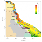
This article outlines the use of two R packages, geoMap and geo, developed to analyse data and generate outputs for the e-atlas and ningaloo-atlas. geoMap generates a variety of plots that can be used for exploratory analysis, presentations and publication-quality maps. geo is an extensive set of spatial modelling techniques that produces fitted surfaces that can be added to publication graphics, or added to the e-atlas as layers, or used as KMLs.
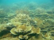
Middle Reef has been exposed to frequent disturbances since surveys began in 1993. Coral cover and coral diversity has been remarkably resilient to high temperatures, freshwater and high sediment loads. Middle Reef is more resilient to bleaching than other reefs around Magnetic Island and the corals are adapted to warm average temperatures. Sediments have high levels of organic carbon and nitrogen. Wave damage from cyclones is a minor threat. However rainfall associated with cyclones or summer low pressure systems can result in exposure to low salinities and long periods of turbidity. Recent outbreaks of atrematous necrosis on Magnetic Island suggest coral disease could be a new risk to Middle Reef. Assessments of the status of Middle Reef in 2010 were postitive (Thompson et al, 2010), based on observed levels of community attributes against estimates of expected change derived from a coral growth model (Thompson and Dolman 2010).
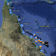
This study forms part of MTSRF Project 2.5i.2c and examines variations in coding regions (genes) of coral DNA and their relative frequency as distributed along a thermal gradient on the Great Barrier Reef. The genes were also investigated for their known or possible roles as an indicator of environmental stress, with particular emphasis on measuring thermal tolerance.
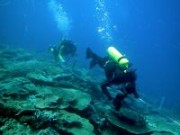
The AIMS Long-Term Monitoring Program (LTMP), initiated in 1993, was designed to track changes in populations of key groups of organisms, particularly crown-of-thorns starfish, corals and reef fishes, on appropriate spatial scales over the length and breadth of the Great Barrier Reef World Heritage Area (GBRWHA).
The specific objectives of the LTMP are:
- To monitor the status and changes in distribution and abundance of reef biota on a large scale.
- To provide environmental managers with a context for assessing impacts of human activities within the GBR Marine Park and with a basis for managing the GBR for ecologically sustainable use.
- To examine the effects of rezoning the GBR Marine Park on biodiversity.
This report (Status Report no. 8) presents a synthesis of LTMP and RAP data collected up to the 2007 field season. Results from 2006 and 2007 have not previously been reported.
The goal of this project (MTSRF Project 2.5i.4) was to develop quantitative modeling tools that help to explain the risks posed to the linked GBR social-ecological system due to the effects of climate change.
This research incorporated field and experimental work on benthic foraminifera as indicators for water quality in the Great Barrier Reef (GBR). Firstly, distribution of benthic foraminifera was examined on 20 reefs in four regions of the GBR (Princess Charlotte Bay, Wet Tropics, Whitsunday Area, and Mid/Outer-shelf reefs), and along a water quality (WQ) gradient in the Whitsunday region. Secondly, manipulative laboratory experiments were carried out to determine whether the distribution of symbiont-bearing foraminifera is controlled by light levels or other environmental factors.


