Northern Australian Reef Mapping through Georeferenced Media - Virtual Fieldwork Toolkit (NESP MaC 3.17, AIMS)
Published on
11 April 2024
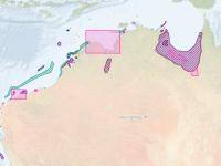
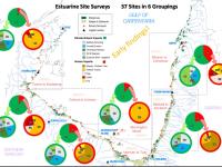
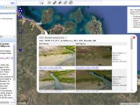
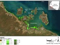
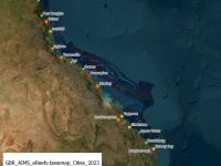
This dataset compiles georeferenced media - including videos (480), articles (20), and datasets (6) - specifically curated to facilitate the understanding of reef habitats across northern Australia. It was designed as a research tool for virtual fieldwork with a particular focus on identifying sources of information that allow an understanding of both inshore and offshore reef environments. This dataset provides a record of the literature and media that was reviewed as part of mapping the reef boundaries from remote sensing as part of project NESP MaC 3.17.