Recent datasets

Water quality logger time series data 2016 to 2020 Cleveland Bay, Halifax Bay and Dunk Island (NESP TWQ 2.1.5 and NESP TWQ 5.8, JCU)

Published on
18 February 2021

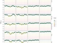
This dataset documents the spatial and temporal variability of resuspension events and sediment dynamics at seven Great Barrier Reef Lagoon inshore locations using continuous logger data (10 min sampling intervals) over 3 ½ years and analysed the quantity of sediment collected in newly designed sediment traps. The dataset highlights the influence of river discharge events on sediment dynamics across these locations. *This dataset is currently under embargo. The key point to note is that this project is primarily interested in the turbidity (SSC), wave pressure and light data.

Predicted distribution of seagrass communities across the Great Barrier Reef World Heritage Area and adjacent estuaries (NESP TWQ 5.4, TropWATER, James Cook University)

Published on
09 February 2021

This dataset describes the predicted distribution of seagrass communities across the Great Barrier Reef World Heritage Area and adjacent estuaries, based on six multivariate regressions tree models for estuary intertidal, estuary subtidal, coastal intertidal, coastal subtidal, reef intertidal, and reef subtidal. The models are presented as six raster datasets with 30m resolution. Managing seagrass resources in the GBRWHA requires adequate information on the spatial extent of seagrass communities.

Transect-based surveys of riparian restoration projects, May 2017 to April 2018 (NESP TWQ 3.1.4, CSIRO)

Published on
04 February 2021

This dataset presents two excel spreadsheets containing the transect-based estimates of biomass carbon and condition score of study sites. The health of the Great Barrier Reef (GBR) is threatened by excessive delivery of sediments (and the pollutants they carry) to the marine environment. Remediation of riparian vegetation is considered an important mechanism for reducing stream bank erosion, improving water quality, and subsequently GBR health outcomes.

Predicted probability of seagrass presence across the Great Barrier Reef World Heritage Area and adjacent estuaries (NESP TWQ 5.4, TropWATER, James Cook University)

Published on
28 January 2021

This dataset describes the predicted probability of seagrass presence across the Great Barrier Reef World Heritage Area and adjacent estuaries, based on six Random Forest models. The models have been mosaicked together into one raster dataset with 30m resolution. Managing seagrass resources in the GBRWHA requires adequate information on the spatial extent of seagrass habitat.

Aesthetic Ratings of Photos of the Great Barrier Reef for Online Survey (NESP TWQ 3.2.4, JCU)

Published on
27 January 2021

This dataset presents the raw data obtained from 1415 online and representative Australian that were asked to aesthetically rate 180 photos of typical coral reef landscapes. Mean aesthetic ratings of 180 photos were collected from the survey, as well as from an expert research team, contributing mean ratings of coral reef health, coral cover, coral pattern, coral topography, fish abundance, and visibility. Please note that CSIRO have published a version of this dataset on 29 May 2019, which should be considered the primary source of data information (i.e.

Macroalgae removal and coral larval seeding experiments on Magnetic Island 2018-2020 (NESP TWQ 4.3, JCU).

Published on
20 January 2021

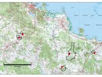
This dataset consists of monitoring data from macroalgae removal and larval seeding experiments in Florence and Arthur Bay at Magnetic Island, Queensland, Australia, collected between 2018-2020. There were twelve 5x5m permanent plots in each bay; three with macroalgae removal only, three with larval seeding only, three with macroalgae removal and larval seeding and three control plots.

R-Software to estimate minimum cost of supplying DIN credits from practice change in cane production in the Wet Tropics (NESP TWQ 3.1.6, GU)

Published on
18 January 2021

P2R.data.reader.v041220 with Header.R This is a block of R code written for NESP Tropical Water Quality Hub Project 3.1.6 The software uses data supplied from the Queensland Government’s Paddock to Reef (P2R) modelling system, and other publicly available data, to generate plots of supply curves for water quality credits in dissolved inorganic nitrogen (DIN) for the main catchments in the Wet Tropics. The aim of Project 3.1.6 was to compare the cost of supplying DIN credits from various sources with the prices that potential credit buyers would be willing to pay for those credits.

Science evaluation of coastal wetland systems repair projects across GBR catchments (NESP TWQ 3.3.2, JCU and Griffith University)

Published on
14 January 2021

This data set contains high frequency logging data to measure water depth, water temperature and electrical conductivity in project wetland sites. In addition fish catch data in wetlands recorded during this project, using electro-fish boat. Coastal wetlands adjacent to the Great Barrier Reef (GBR) have incredible environmental, cultural and economic value. Despite this, many floodplains in the GBR catchments have been modified, impacted or lost entirely because of continuing land use change (such as agricultural, aquaculture, peri-urban/urban, and industrial expansion).

Climate change doubles sedimentation-induced coral recruit mortality (NESP TWQ 5.2, AIMS, JCU and AIMS@JCU)

Published on
07 January 2021

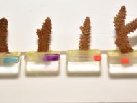
This dataset consists of one spreadsheet, which shows the survival, number of polyps and ability to remove sediment of up to fourteen weeks old Acropora millepora coral recruits while being exposed to three different climate scenarios resembling current climate conditions and conditions expected by mid and end of the century. Coral recruit resilience towards sedimentation was tested by exposing the recruits either five- and ten-weeks following settlement (experiment 1) or only ten-weeks following settlement (experiment 2).

Oceanographic drivers of bleaching in the GBR: Hazard maps for 2016 - 2017 (NESP TWQ 4.2, AIMS)

Published on
18 December 2020

This dataset explores a new approach to predict coral bleaching events. It uses a temperature anomaly map to create a spatially dynamic temperature threshold for the calculation of degree heating weeks (DHW) instead of using a static constant. The dynamic threshold was used to classifies map areas with low, medium or high risk of coral bleaching for years 2016 and 2017.

Exposure of acute and chronic environmental disturbances affecting coral cover on the GBR from 1992 to 2017 (NESP TWQ 5.2, AIMS)

Published on
16 December 2020

The dataset consist consists of two (A-B) csv files and one excel file (E). File A shows 1) the absolute percentage total cover and that of specific coral growth forms: Acropora tabular, Acropora branching, other branching species, and massive/submassive species surveyed at 5-9 m depth on 122 reefs (335 reef sites) by the AIMS Long-Term Monitoring Program (LTMP) and Marine Monitoring Program (MMP) between 1992 and 2017 and 2) the long-term average exposure of each reef to variable conditions in water quality (e.g.

Registered Native Title Bodies Corporate (RNTBC) - November 2020 (NNTT)

Published on
25 November 2020

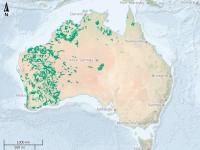
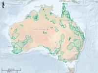
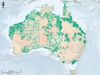
RNTBCs (Registered Native Title Bodies Corporate) are corporations which have prescribed functions under the Native Title Act 1993 (NTA) to hold, protect and manage determined native title and ensure certainty for governments and other parties interested in accessing or regulating native title land and waters by providing a legal entity to manage and conduct the affairs of the native title holders. PBCs (Prescribed Bodies Corporate) are established as an interim measure to represent native title owners and their interests until an RNTBC is formally registered.

Assessment of deep-water habitat for crown-of-thorns starfish (COTS) in the Great Barrier Reef (NESP TWQ 3.1.1, JCU)

Published on
25 November 2020

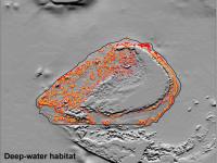
This project integrated all the available source bathymetry data currently used within the latest gbr100 grid and generated a much higher-resolution gbr30 bathymetry grid (~30 m pixel spacing) over the GBR shelf area. The gbr30 grid is recommended for use as a spatial dataset to feed into the Local and Regional Decision Support Tool (DST) being developed by CSIRO for Integrated Pest Management.

GBR photosynthetically active radiation (PAR) at 8 m depth from ocean colour, 2002-2019 (NESP TWQ 5.3, AIMS, Go2Q Consulting and JCU)

Published on
25 November 2020
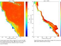
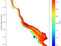
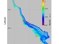
This dataset contains estimated daily integrated photosynthetically active radiation (PAR) at 8 m depth in the Great Barrier Reef Marine Park and Coral Sea for each day from April 2002 through to December 2019. Data are provided on a 1km grid. The amount of light available for photosynthesis (photosynthetically active radiation, or PAR) is an important determinant of ecosystem health. PAR at 8 m depth is relevant to many coral and seagrass habitats.
Code for generating benthic photosynthetically active radiation (bPAR) and the bPAR index as reported in (NESP TWQ 5.3, AIMS, JCU and Go2Q)

Published on
24 November 2020

This dataset contains code used to generate the daily benthic light (bPAR) data product provided at https://eatlas.org.au/data/u...ec8a67cef and the bPAR index for water quality in the Great Barrier Reef (GBR). It can also be used to calculate photosynthetically active radiation (PAR) at any specified depth in GBR waters. The amount of light available for photosynthesis (photosynthetically active radiation, or PAR) is an important determinant of ecosystem health.

Annual and seasonal bPAR index values for each NRM Region and Waterbody as reported in (NESP TWQ 5.3, AIMS and JCU)

Published on
24 November 2020

This dataset contains annual and seasonal values of the benthic light (bPAR index) for water quality on the Great Barrier Reef as calculated for each NRM Region (Cape York, Wet Tropics, Dry Tropics, Fitzroy and Mary-Burnett) and waterbody (Closed Coastal, Open Coastal, Midshelf and Offshore) for each water year between 2003 and 2019, as reported in NESP TWQ Project 5.3. Code used to produce these values is also available through eAtlas, as is the daily bPAR data.

Future act Objections - November 2020 (NNTT)

Published on
19 November 2020

A future act objection is where a native title party objects to the inclusion of a statement that the act attracts the expedited procedure (s 32 of the NTA). A future act is considered to attract the expedited procedure if the act: it is unlikely to interfere with the native title holders' community or social activities; areas or sites of particular significance; or cause major disturbance to any land or waters concerned (s 237 of the NTA).

Register of Native Title Claims - November 2020 (NNTT)

Published on
19 November 2020

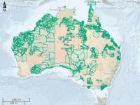
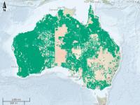
The Register of Native Title Claims is kept by the Native Title Registrar pursuant to s 185 of the NTA to hold information on claimant applications that have satisfied the registration requirements set out in ss 190B and 190C of the NTA. Native title claimants whose applications have been accepted for registration are afforded a number of procedural rights in relation to future acts that affect native title including the right to negotiate, the right to be notified, the right to comment, the right to request consultation, or the right to object as prescribed under the NTA.

Future act Notices - November 2020 (NNTT)

Published on
19 November 2020

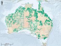
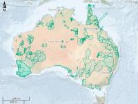
Before an act is done, which may affect native title, a Government party must issue a notice under s 29 of the NTA (s 29 notice or future act notice). The notice provides details of the proposed act and specifies a date (notification date) from which persons have either 3 or 4 months to object to the act or become a native title party with rights to negotiate about the doing of the act. Note: This metadata record is a local copy maintained for the eAtlas and is not authoritative. Please see the link to the 'Original metadata record for this dataset' for the full metadata and latest update.