NESP MaC Project Maps - Areas of research activity (NESP MaC, AIMS, UTAS)
Published on
27 June 2023
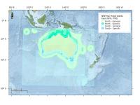
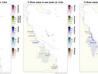
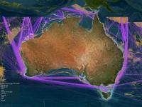
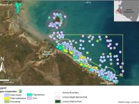
This dataset contains 63 shapefiles that represent the areas of relevance for each research project under the National Environmental Science Program Marine and Coastal Hub, northern and southern node projects for Rounds 1, 2 & 3. Methods: Each project map is developed using the following steps: 1. The project map was drawn based on the information provided in the research project proposals. 2. The map was refined based on feedback during the first data discussions with the project leader. 3.