Derelict fishing line on fringing reefs of inshore groups of the GBR, 2007-2009 (NERP TE 8.2, JCU)
Published on
26 November 2014
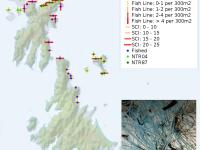
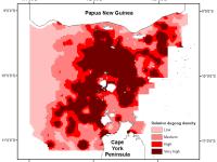
This dataset consists of site means of the density of derelict fishing line, the percent cover of major benthic categories on fringing coral reefs of the Keppel, Whitsunday and Palm Island groups, and the accumulation rate of fishing line at ten sites in the Palm Islands between 2007 and 2009. Monofilament nylon fishing line is persistent in the marine environment and once entangled in the reef, it can remain in place for many years. Temporal monitoring of the relative number of fishing lines recorded at each site can be used as a proxy for fishing effort.