Recent datasets

NERP TE Project 3.1 - Rainforest Biodiversity: (a) Monitoring; (b) Climate change vulnerability and adaptation; (c) Determinants of biodiversity – synthesis and integration; and (d) Status, trends and future predictions, 2011-2014 (JCU)

Published on
22 July 2011

This project will act as an integrating focus within the rainforest theme to strategically target research gaps and thereby increase our understanding of the drivers of rainforest biodiversity. We will generate high resolution maps and landscape scale estimates of temporal trends in the condition of biodiversity and environmental changes. The project consists of four subprojects: A. Monitoring: Tasks include a microsensor network, standardised vertebrate surveys, habitat structure monitoring and data harvesting from other projects.

NERP TE Project 5.2 - Experimental and field investigations of combined water quality and climate effects on corals and other reef organisms, 2011-2014 (AIMS)

Published on
22 July 2011

The objective of this project is to assess how management of local stressors such as land runoff can help improve the resilience of coral reefs to global stressors (climate change) which are more difficult to manage. Complementary laboratory and field experiments will investigate the combined impacts of declining water quality (increased nutrients and sediments, and reduced light and salinity), increased sea temperature and ocean acidification on key reef species groups such as corals, foraminifera, crown-of-thorns starfish and rock-boring sea urchins. 1.

Marine Sediments database (MARS) (GA)

Published on
13 April 2011

The MARine Sediment (MARS) database contains detailed information on seabed sediment characteristics for samples collected from Australia's marine jurisdiction, including the Australian Antarctic Territory. It also includes the Geat Barrier Reef (GBR). It is an important scientific resource that includes survey and sample information such as locations, water depths and sample descriptions.

Project - Torres Strait Sustainable Land Use Plan (SLUP) 2010 (TSRA, RPS)

Published on
07 March 2011

This project seeks to ensure that planning for the future development of the Torres Strait Islands is sustainable and capable of taking into account ecological and social information, assets, risk and existing infrastructure. This Plan provides the following information for each island: •identification of key environmental assets; •identification of key land management issues; •identification of key infrastructure needs; •land use mapping identifying land suitable for development and conservation; and •land use for the future sustainable management.

eAtlas Web Mapping Service (WMS) (AIMS)

Published on
01 January 2011

The eAtlas delivers its mapping products via two Web Mapping Services, a legacy server (from 2008-2011) and a newer primary server (2011+) to which all new content is added. This record describes the primary WMS. This service delivers map layers associated with the eAtlas project (https://eatlas.org.au), which contains map layers of environmental research focusing on the Great Barrier Reef and its neighbouring coast, the Wet Tropics rainforests and Torres Strait. It also includes lots of reference datasets that provide context for the research data.

Project 3DGBR: gbr100 High-resolution Bathymetry for the Great Barrier Reef and Coral Sea (JCU)

Published on
20 August 2010

The gbr100 dataset is a high-resolution bathymetry and Digital Elevation Model (DEM) covering the Great Barrier Reef, Coral Sea and neighbouring Queensland coastline. This DEM has a grid pixel size of 0.001-arc degrees (~100m) with a horizontal datum of WGS84 and a vertical datum of Mean Sea Level (MSL). For the latest version of this dataset download the data from http://deepreef.org/bathymet...athy.html This dataset was developed as part of the 3DGBR project.

Mission Beach - Habitat quality, canopy cover, tenure type (6 months after cyclone Larry), 2006 (MTSRF 4.9.3, JCU)

Published on
20 July 2010

This dataset consists of an atlas of the habitat quality of the urbanized and agricultural landscapes of the Mission beach region in August 2006, 6 months after cyclone Larry. This analysis and classification includes habitat quality, canopy cover, vegetation quality, vegetation types, tenure type and aerial photography at a resolution of 0.5m. These maps of habitat quality highlight potential priority areas for maintenance and/or restoration of connectivity and is a tool for natural resource managers to implement restoration goals at Mission beach.

Queensland Coastal Wetlands (Mangroves, saltpans, samphire), 1987 - 1997 (DEEDI)

Published on
08 July 2010

1:100,000 coastal wetland vegetation mapping for the Queensland coastline including mangrove communities, saltpans and saline grasslands. Mangrove areas are classified based on the dominant genus (Ageiceras, Avicennia, Ceriops, Bruguiera, Rhizophora). This dataset was derived from automatic classification of 25m resolution Landsat TM images, colour aerial photography and ground truthing. The resulting data has a positional accuracy of 100 meters and a classification accuracy of approximately 80%.

Collaborative Australian Protected Areas Database (CAPAD) 2010 - External

Published on
01 July 2010

The Collaborative Australian Protected Areas Database (CAPAD) 2010 provides both spatial and text information about government, Indigenous and privately protected areas for continental Australia. State and Territory conservation agencies supplied data current for various dates between June 2010 and January 2011. This is the eighth version of the database, with previous versions released in 1997, 1999, 2000, 2002, 2004, 2006 and 2008.

GBR - Dating and mapping historical changes in Great Barrier Reef coral communities, 2007 - 2010 (MTSRF 1.1.4, UQ)

Published on
15 June 2010
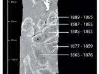
Trajectories of decline have been observed in coral reefs throughout the Caribbean and Indo-Pacific region attributable to the synergistic effects of human-induced disturbances. Whilst direct and indirect evidence suggests that inshore reefs from the Great Barrier Reef (GBR) are showing signs of regional decline following European settlement in the mid 18th century, it has proven difficult to ascertain the link between anthropogenic disturbance and coral degradation on a regional scale.
Interactive effects of herbicides and higher sea surface temperatures on Great Barrier Reef corals and crustose coralline algae (MTSRF Project 3.7.1a)

Published on
10 June 2010

The coral, Acropora millepora and the crustose coralline algae, Neogoniolithon fosliei were exposed to 3 photosystem II (PSII) herbicides (diuron, hexazinone and atrazine). Corals were collected at depths between 1 and 3m from Double Cone Island and Hayman Island in the Whitsunday group. The crustose coralline algae was collected from Davies Reef at depths between 5 and 7m.Experiments assessed the effects of the variables temperature (26, 30, 31, 32 °C) in combination with 3 herbicide concentrations, and exposure duration (up to 7 days) on photosynthetic efficiency and bleaching.

Seabird life history and climate variation on the Great Barrier Reef, 2001 - 2010 (MTSRF 2.5i.2, JCU)

Published on
10 June 2010

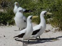
To date the seabird research program has: 1. Quantified how increases in El-Nino intensity and sea-surface temperatures (SST) result in decreased breeding participation, increased foraging effort, reduced food availability, poor chick growth and/or reproductive failure across multiple seabird species in both the northern and southern GBR. 2. Identified important seabird foraging areas/regions that the lie both within and outside the GBR region 3. Identified physiochemical and oceanographic correlates associated with both the important foraging areas and El-Nino/SST impacts 4.

GBR - Drivers of change in seagrasses of the Great Barrier Reef, 2008 - 2010 (MTSRF 1.1.3b, JCU)

Published on
08 June 2010

The aims of this work (MTSRF Project 1.1.3b) were to identify the role of light and water temperature as drivers of change in seagrass meadows of the northern Great Barrier Reef. Experimental approaches as well as field investigations were undertaken. Field studies occurred at four locations (Magnetic Island, Dunk Island, Green Island, Low Isles). There was continuous monitoring of light and temperature at seagrass canopy height in both intertidal (above lowest astronomical tide, LAT) and near-by subtidal meadows (1-3m below LAT) at each of the four locations.

GBR - Benthic communities, juvenile corals and sources of coral mortality on the Great Barrier Reef, 1993 - 2010 (AIMS LTMP)

Published on
08 June 2010

The purpose of this study is to detect and quantify spatial and temporal changes in benthic communities and juvenile coral assemblages of the Great Barrier Reef (GBR). Additionally, spatial and temporal variation in sources of coral mortality are monitored to assist with interpretation of changes in benthic assemblages. Between 1993 and 2005, benthic assemblages of 46 reefs were monitored annually along permanent transects within a standard habitat using underwater video/digital still photography.

Upwelling and bleaching on the Great Barrier Reef (MTSRF Project 2.5i.2)

Published on
01 June 2010

As part of MTSRF Task 2.5i.2, a range of indices were investigated to quantify upwelling on the central Great Barrier Reef (GBR), Australia. These indices are necessary for exploring environmental and biological relationships in areas where upwelling may be sporadic and less intense, especially along western boundary currents such as the East Australian Current.

GBR - Green zone contribution to the larval recruitment of three fish species in blue zones, 2007 - 2008 (MTSRF 4.8.1, JCU)

Published on
01 June 2010

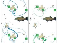
As part of MTSRF Project 4.8.1, this study aimed to assess the benefit of no-take (green) zones as a recruitment source. 1342 adult stripey snapper (Lutjanus carponotatus) from 3 green zones around the Keppel Islands were fin-clipped for genetic analysis and released. Microsatellite markers were used to assign juveniles to one or both parents. From the 483 juveniles collected from 16 sites in both green and blue zones, 140 (~30%) were assigned to one or both parents from the adult sample.