NERP TE Project 9.1 - Dynamic vulnerability maps and decision support tools for the Great Barrier Reef, 2011-2014 (AIMS)
Published on
22 July 2011
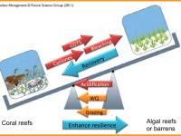
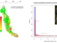
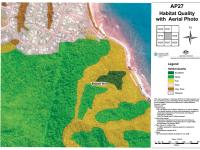
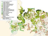
To support management of the Great Barrier Reef Marine Park, coral reef managers need decision support tools that can integrate physical and biological information at a variety of spatial and temporal scales. In this project we will construct vulnerability maps for the Great Barrier Reef (GBR) This project will deliver a novel framework for linking impacts of environmental change to spatial patterns of coral reef resilience and vulnerability.