Recent datasets

NERP TE Project 4.1 - Tracking coastal turbidity over time and demonstrating the effects of river discharge events on regional turbidity in the GBR, 2012-2014 (AIMS)

Published on
22 July 2012

Turbidity is a measure of water clarity that quantifies the amount of small particles suspended in the water, and is a fundamental environmental parameter influencing coastal marine ecosystems. Turbidity reduces the light needed for photosynthesis by corals and seagrasses, and suspended particles also transport nutrients, pollutants and diseases. Previous research based on 3 years of turbidity data collected from 15 inshore reefs by the Reef Rescue Marine Monitoring Program has shown that it can take several months for water clarity to improve after river floods.

NERP TE Project 10.2 - Socio-economic systems and reef resilience, 2012-2014 (JCU)

Published on
22 July 2012

This project focuses on relationships between socio-economic systems and the Great Barrier Reef (GBR). It comprises three interrelated activities to investigate: 1. Resident and tourist views about the relative ‘value’ of key ecosystem services that are provided by the reef. Researchers will design, distribute and analyse the results of a survey instrument to assess the relative value of different goods and services produced by the GBR to stakeholder groups using both traditional money-based valuation techniques and Larson’s non-monetary based technique. 2.

Aerial photo mosaic of Atherton Tablelands in June 1978 (NERP TE 12.2, Griffith, source: DERM)

Published on
01 April 2012

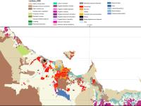
This dataset is a photo mosaic of historic aerial imagery of the southern Atherton Tablelands from 16th June 1978. It includes the towns of Atherton, Malanda, Yungaburra and Tolga. It has a southern boundary just north of Millaa Millaa, a northern boundary of Lake Tinaroo, an eastern boundary of a quarter of Wooroonooran National Park and a western boundary of Atherton.

Project 3DGBR: Great Barrier Reef and Coral Sea Geomorphic Features (MTSRF 2.5i.1, JCU)

Published on
15 February 2012

This phase of Project 3DGBR involved manual digitising of geomorphic map boundaries for the key seafloor features identified in the gbr100 grid, particularly for the inter-reefal area on the GBR shelf and in the Coral Sea Conservation Zone (CSCZ). See map for CSCZ boundary at: https://www.environment.gov....tion-zone Methods: GIS spatial analysis of the gbr100 grid was conducted in order to derive a number of useful background datasets for assisting in the digitising process, such as slope, aspect, hillshading, and dense contour lines.

Catch and biological data for blacktip reef sharks sampled in the inshore GBRWHA 2008 - 2011 (MTSRF 4.8.4, JCU)

Published on
01 November 2011

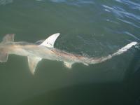
Catch data from fisheries independent sampling in inshore habitats (inshore reefs, intertidal flats/foreshores, seagrasses and mangroves) of the GBRWHA (Cleveland Bay and Halifax Bay) using bottom-set multihook research lines (long lines) geared to capturing sharks Data includes catch and effort data for all species captured. Data includes biological data of captured blacktip reef sharks - BTS (Carcharhinus melanopterus). Data also includes simple water quality parameters for sample locations (temperature, secchi disc depth, dissolved oxygen, salinity measured with a YSI).

Torres Strait Dugong distribution and relative density - Spatial model of aerial surveys from 1987 - 2011 (NERP TE 2.1, JCU)

Published on
02 August 2011

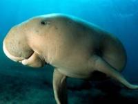
This dataset shows a raster spatial model of the distribution and relative density of dugongs (Dugong dugong) in the Torres Strait region based on an aggregate of 24 years (1987 - 2011) of systematic aerial surveys. Aerial surveys were conducted using the strip transect method described by Marsh and Sinclair (1989). The survey region was divided into blocks containing systematic transects of varying length, which were typically perpendicular to the coast across the depth gradient.

NERP Torres Strait/GBR environmental conditions reports, including SST, coral bleaching risk, Chlorophyll-a and ocean currents 2011 - 2014 (NERP TE 2.3, UQ)

Published on
01 August 2011

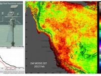
The Biophysical Oceanography Group produces monthly oceanographic reports for the eastern Australian coast, including the Torres Strait, which summarise key environmental variables such as sea surface temperature (SST) and chlorophyll concentration. These variables are important indicators for coral reef ecosystems and other biological processes.

NERP TE Project 4.4 - Hazard assessment for water quality threats to Torres Strait marine waters, ecosystems and public health, 2011-2013 (JCU)

Published on
22 July 2011

This project involved an assessment of all existing and potential sources of pollution to the Torres Strait marine environment. This was combined with information on water movement patterns to assess the hazard (and to some degree risk) of these pollutant sources to marine ecosystems and public health. This project was predominantly a desktop study with some field work to sewage treatment plants, and other point sources of potential pollutants. This project: 1. Collated information regarding Torres Strait water quality pollutant sources at a range of scales (regional to local). 2.

NERP TE Project 12.1 - Indigenous co-management and biodiversity protection, 2011-2014 (CSIRO)

Published on
22 July 2011

The project seeks to improve understanding of practices that can underpin co-management arrangements for conservation areas, including the Wet Tropics World Heritage Area (WTWHA). A co-research team of CSIRO scientists, Rainforest Aboriginal peoples, protected area managers and other key partners will investigate the potential of Indigenous Protected Areas (IPAs), and other collaborative models and tools, to engage Indigenous values and world views. The team will focus on the conditions under which these arrangements lead to effective joint management.

NERP TE Project 4.3 - Ecological risk assessment of pesticides, nutrients and sediments on water quality and ecosystem health – Phase 1, 2011-2012 (CSIRO, JCU)

Published on
22 July 2011

This project undertook a scoping study to develop a robust approach that will allow us in Phase 2 to carry out an ecological risk assessment (ERA) of nutrients, fine suspended sediments, and pesticides used in agriculture in the GBR region including ranking the relative risk of individual contaminants originating from priority catchments to the GBR ecosystems using a systematic, objective and transparent approach. The researchers will specifically look at a method able to evaluate relative risk to different ecosystems and their keynote species from the different contaminants, e.g.

NERP TE Project 7.3 - Climate change and the impacts of extreme climatic events on Australia’s Wet Tropics biodiversity, 2011-2014 (JCU)

Published on
22 July 2011

This project investigates in detail the exposure and sensitivity of Wet Tropics animals to extreme climate and weather events, such as heat waves, fires, flooding rain and cyclones. This information will be used to assess and map the vulnerability of biodiversity to the impacts of current and future extreme events in the Wet Tropics bioregion. The information gathered in the Wet Tropics can potentially be applied to other regions in Australia and elsewhere to predict and mitigate the impacts of extreme climatic events on biodiversity.

NERP TE Project 12.4 - Governance, planning and the effective application of emerging ecosystem service markets to secure climate change adaptation and landscape resilience in Far North Queensland, 2011-2013 (JCU)

Published on
22 July 2011

This project involved working with a range of stakeholders to identify the most effective governance systems for managing climate change adaptation in the Wet Tropics through the emergence of new ecosystem service markets, including Carbon Farming. The project will directly contribute to: Regional climate change adaptation policies and planning processes, Regional Natural Resource Management (NRM) organisations’ role in guiding emerging carbon markets in Australia and the region. This project developed: 1.

NERP TE Project 6.1 - Maximising the benefits of mobile predators to GBR ecosystems: the importance of movement, habitat and environment, 2011-2014 (AIMS)

Published on
22 July 2011

This project will determine the movement and habitat use of large predatory fishes such as sharks and coral trout in reef and coastal environments of the Great Barrier Reef. This project will employ acoustic monitoring technology in a series of inshore and offshore environments including coastal bays, inshore reefs and offshore reefs to monitor the presence and movements of predator species (elasmobranchs and teleosts).

NERP TE Project 1.1 - Monitoring status and trends of coral reefs of the GBR, 2011-2014 (AIMS)

Published on
22 July 2011

This project will continue a unique data set that documents long-term trends in coral reef communities of the Great Barrier Reef (GBR). In 2012-13 and 2014-15 the LTMP will resurvey the ‘core’ reefs that have been surveyed since 1992. The AIMS LTMP has made intensive surveys of 47 ‘core’ reefs since 1992. The survey reefs are stratified by latitude and position across the GBR lagoon so as to give broad geographic coverage.

NERP TE Project 9.3 - Prioritising management actions for Great Barrier Reef islands, 2011-2014 (JCU)

Published on
22 July 2011

This project will develop a cost-effective approach for prioritising management actions across Great Barrier Reef islands to maximise conservation outcomes. The approach will be broad-based and include pest control, adjustment of fire regimes, biosecurity measures and monitoring. A decision-support tool with GIS capability will help managers to identify management priorities within and between islands.The sub-region selected for this project includes 150 islands within the Great Barrier Reef World Heritage Area from south of Mackay to Bundaberg.

Point of contact

NERP TE Project 8.1 - Monitoring the ecological effects of the Great Barrier Reef Zoning Plan on mid- and outer-shelf reefs, 2011-2014 (AIMS)

Published on
22 July 2011

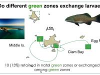
The rezoning of the Great Barrier Reef Marine Park (GBRMP) in 2004 increased the number and extent of ‘no-take’ areas within the Park. This project surveys pairs of reefs, one in a ‘no-take’ or green zone and the other a similar reef where fishing is allowed (blue zone), in five regions of the GBRMP. Green and blue zones will be surveyed for the abundance and size of fishery species, particularly coral trout, as well as wider effects on coral reef communities. The results of reef surveys will be used to: 1.

NERP TE Project 7.1 - Fire and rainforests, 2011-2014 (CSIRO)

Published on
22 July 2011

Little is known about the impacts of fire on rainforest vegetation or the animals which depend on it. This project will investigate the positive and negative impacts of fire on rainforest vegetation and wildlife. In collaboration with NPRSR rangers, and where possible with local NGOs and Indigenous Rangers, we propose to establish vegetation and faunal monitoring sites across the rainforest/woodland boundaries and associated vegetation types in key areas of the Mission Beach, Tully lowlands and Hinchinbrook Channel areas to assess faunal and floral status and trends.

NERP TE Project 3.4 - Monitoring of key vertebrate species, 2011-2014 (CSIRO)

Published on
22 July 2011

This project will implement monitoring programs for the endangered southern cassowary, Casuarisus casuarius, and the vulnerable spectacled flying-fox, Pteropus conspicillatus. Cassowary monitoring will be based on regular surveys to collect dung. DNA fingerprinting of the bird dung will provide data on cassowary abundance and distribution, the influence of habitat type and the structure and phylogeography of cassowary populations across the region. For spectacled flying-fox monthly surveys of all known spectacled flying-fox camps in the Wet Tropics Region will be conducted.

NERP TE Project 8.2 - Do no-take marine reserves contribute to biodiversity and fishery sustainability? Assessing the effects of management zoning on inshore reefs of the Great Barrier Reef Marine Park , 2011-2014 (JCU)

Published on
22 July 2011

This project is providing a direct assessment of the ecological effects of multiple-use zoning on inshore reefs of the GBRMP. Underwater visual census (UVC) monitoring of fish and benthic communities is being carried out at 50 no-take marine reserve (green zone) sites and at 50 sites that have remained open to fishing within the Palm, Magnetic, Whitsunday and Keppel Island groups. Long-term monitoring surveys are providing information on: 1. The effects of no-take marine reserves on populations of both species that are fished and other non-fished species. 2.

NERP TE Project 12.2 - Harnessing natural regeneration for cost-effective rainforest restoration, 2011-2014 (GU, UQ)

Published on
22 July 2011
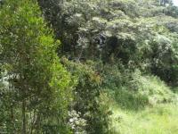
The project will assist decision-makers to more efficiently restore biodiversity to degraded rainforest landscapes by providing new knowledge about the outcomes of lower-cost natural regeneration (including potential for minimum intervention management) relative to higher-cost active reforestation (replanting) on post-agricultural land. The outcomes of this project will enable planners to assess the costs, risks and benefits of different approaches to reforestation and choose the most appropriate method for any particular ecological and economic context. This project will: 1.