Recent datasets

Great Barrier Reef Marine Park Boundary (GBRMPA)

Published on
01 March 2008

Boundaries of the Great Barrier Reef Marine Park proclaimed under Subsection 31(1) of the Great Barrier Reef Marine Park Act 1975 (CTH). For administrative purposes, the Amalgamated Great Barrier Reef Section is divided into four management areas. This metadata record was created for the eAtlas and is not authoritative. Please contact GBRMPA for more information. To obtain this dataset go to the GBRMPA spatial information website, download the appropriate data usage agreement and send it through to gis@gbrmpa.gov.au.

Point of contact

Special Management Areas (SMA) within Great Barrier Reef Marine Park 1983 (GBRMPA)

Published on
01 March 2008

This dataset contains the amalgamated set of Special Management Areas (SMAs) in the Great Barrier Reef Marine Park as described in the Great Barrier Reef Marine Park Regulations 1983, Amendments 2008. This includes: SMA - No Dories Detached, SMA - Princess Charlotte Bay, SMA - Public Appreciation, SMA - Restricted Access, SMA - Seasonal Closure, SMA - Dugong Protection Area B, SMA - Dugong Protection Area A, SMA - Natural Resources Conservation Dugong Protection Areas: This layer shows the Special Management Areas that provide additional protection for Dugongs from commercial fishing.

Great Barrier Reef (GBR) Features (Reef boundaries, QLD Mainland, Islands, Cays, Rocks and Dry Reefs) (GBRMPA)

Published on
01 October 2007

This dataset contains coastal features within and adjacent to the Great Barrier Reef World Heritage area. This dataset consists of two shapefiles GBR_FEATURES.shp and GBR_DRY_REEF.shp. The GBR_FEATURES shapefile contains the following features: Queensland mainland coastline, Major and other coral reef structures (as defined by the reef shoal edge), Islands and rocks (exposed and submerged), Major coral cay features. The GBR_DRY_REEFS contains major coral reef structures (as defined by the reef shoal edge) that are tidal, drying or emergent reef areas.

Composite Inshore Seagrass Distribution - GBRWHA and Hervey Bay - 1984 - 2007 (QDPI-F)

Published on
27 June 2007

This dataset is shows the distribution of inshore seagrass along the eastern Queensland coastline. It is a composite of 38 surveys conducted from 1984 to 2007. Coastal seagrasses in waters shallower than -15 metres were mapped by dive surveys, under water cameras and inter-tidal aerial surveys. The data includes location information on the spatial extent of seagrass habitats mapped in 38 surveys between 1984 – 2007. The data does not include species information.

Great Barrier Reef dugong distribution and relative density - Spatial model of aerial surveys from 1986 - 2005 (MTSRF, JCU)

Published on
05 March 2007

This dataset shows a spatial model of the distribution and relative density of dugongs (Dugong dugong) in the Torres Strait region based on an aggregate of 19 years (1986, 1987, 1992, 1994, 1999, and 2005) of systematic aerial surveys. For more information on the methods used in the creation of this dataset see Grech. A., and Marsh. H. (2007) - Prioritising areas for dugong conservation in a marine protected area using a spatially explicit population model, Applied GIS, 3(2), 1-14.

Indigenous Protected Areas (IPA) - Declared - April 2015 (Department of the Environment)

Published on
01 August 2006

This dataset details the Declared Indigenous Protected Areas (IPA) across Australia through the implementation of the Indigenous Protected Areas Programme. These boundaries are not legally binding. An Indigenous Protected Area (IPA) is an area of Indigenous-owned land or sea where traditional Indigenous owners have entered into an agreement with the Australian Government to promote biodiversity and cultural resource conservation.

Australian Maritime Boundaries (AMB) and Petroleum (Submerged Lands) Act 1967 (2006) - Superseded

Published on
01 January 2006

Geoscience Australia has the primary role in the delineation of Australia's maritime boundaries. An output of this activity is the development of the Australian Maritime Boundaries (AMB) data. AMB is a GIS data product, replacing AMBIS 2001 Version 1.1, providing access to the data for Australia's Territorial Sea Baseline (TSB) and maritime zones. Note: This is a non authoritative copy of the metadata for the use in the eAtlas. Please refer to Geoscience Australia for queries on this dataset.

Great Barrier Reef Marine Park Designated Shipping Areas (GBRMPA)

Published on
01 September 2004

There are 10 major trading ports along the Great Barrier Reef coast. The waters of most of these ports are within the Great Barrier Reef Region, but not within the Great Barrier Reef Marine Park. In recognition of the outstanding values of the Great Barrier Reef, there are stringent management arrangements for commercial shipping in the waters of the Great Barrier Reef, which is designated a Particularly Sensitive Sea Area by the International Maritime Organisation. Shipping traffic is confined to Designated Shipping Areas in the Great Barrier Reef Region.

Oil and Gas Pipelines of Australia 2004 (GA)

Published on
01 January 2004

This data set contains information on Oil and Gas pipeline infrastructure. This dataset has been converted from Microstation format used in a map "Petroleum Exploration and Development Titles" published annually in APRIL. Attributes have been added to comply with data standards and minor coding of line work has been achieved using annotation from the map. Further data has been added, specifically for the specific Acreage Release Areas. This metadata was prepared for the North West Atlas and is not authoritative.

Australia's River Basins 1997 (GA)

Published on
01 January 2004

Australia's River Basins 1997 is the result of a joint State, Territory and Commonwealth Government project to create a national spatial database of major hydrological basins. It shows the boundaries of Australia's basins as defined by the Australian Water Resources Management Committee (WRMC). Australia is divided into drainage divisions which are sub-divided into water regions which are in-turn sub-divided into river basins. The data includes the name and number of each of the 245 drainage basins, 77 regions, and 12 divisions.

GEODATA TOPO 2.5M 2003 (GA)

Published on
01 October 2003

The GEODATA TOPO 2.5M 2003 product is a national seamless data product aimed at regional or national applications. It is a vector representation of the Australian landscape as represented on the Geoscience Australia 1:2.5M general reference maps and is suitable for GIS applications. It supersedes the TOPO 2.5M 1998 product by being developed according to GEODATA standards as described below. The data was derived from GEODATA TOPO 250K Series 2 data where available and GEODATA TOPO 250K Series 1 and has double precision accuracy.

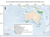
[SUPERSEDED] Australia's network of Commonwealth Marine Reserves 2014 (DCCEEW)

Published on
16 August 1982

This dataset is not the current marine park zoning. It is retained here for historic purposes. See http://www.environment.gov.a...E5AF3C%7D for current zoning. Consistent with the Australian Government's commitment to develop a National Representative System of Marine Protected Areas (MPAs), networks of Commonwealth Marine Reserves have been proclaimed for Commonwealth waters across the South-west, North-west, North, Coral Sea and Temperate East Marine Regions.