Recent datasets

230Th age results for 104 individual dead coral samples obtained from Keswick, Round Top, Scawfell and Derwent Island in 2006 (MTSRF 1.1.4, NERP TE 1.3, UQ)

Published on
07 July 2026
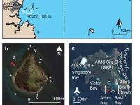
This dataset consists of the raw data used to calculate 230Th ages for 104 individual dead coral samples obtained from Keswick, Round Top, Scawfell and Derwent Island (Mackay region, Great Barrier Reef) in 2006. Samples were measured using both thermal ionisation mass spectrometry (TIMS) and multi collector inductively coupled plasma mass spectrometry (MC ICPMS) at the Radiogenic Isotope Facility, The University of Queensland.
Dungeness Reef Seagrass Survey, Torres Strait, December 2021 (TropWATER, James Cook University)

Published on
01 July 2026

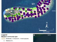
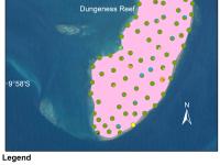
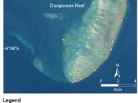
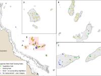
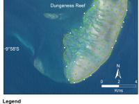
This dataset summarises intertidal benthic surveys of Dungeness Reef, Torres Strait, in December 2021 into 3 GIS shapefiles. (1) The point (site) shapefile describes (a) seagrass presence/absence and (b) species composition across 140 sites. (2) The meadow shapefile describes seagrass communities for the intertidal meadows. (3) The interpolation shapefile describes variation in seagrass biomass across sites for the intertidal meadows. The full report is: Carter AB, Hoffmann LR, Scott A, David M, Torres Strait Regional Authority Land and Sea Rangers, and Rasheed MA (2022).

Eastern Torres Strait intertidal benthic survey: Ugar, Campbell and Nepean Islands (TropWATER, James Cook University)

Published on
10 June 2026

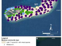
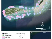
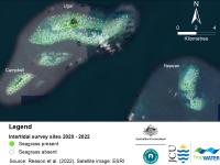
This dataset summarises intertidal benthic surveys of Ugar, Campbell, Nepean Islands, Torres Strait, in March 2022 into 3 GIS shapefiles. (1) The point (site) shapefile describes (a) seagrass presence/absence, (b) species composition, (c) algae cover and (d) benthic macro-invertebrate cover at 404 sites. (2) The meadow shapefile describes seagrass communities for the intertidal meadows. (3) The interpolation shapefile describes variation in seagrass biomass across sites for the intertidal meadows.

Orman Reefs Seagrass Survey, Torres Strait, September 2021 (TropWATER, James Cook University)

Published on
03 June 2026

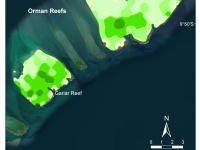
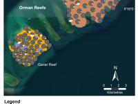
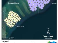
This dataset summarises intertidal benthic surveys of Orman Reefs, Torres Strait, in September 2021 into 3 GIS shapefiles. (1) The point (site) shapefile describes (a) seagrass presence/absence and (b) seagrass species composition and composition across 151 sites. (2) The meadow shapefile describes seagrass communities for the intertidal meadows. (3) The interpolation shapefile describes variation in seagrass biomass across sites for the intertidal meadows.

Orman Reefs Seagrass Survey, Torres Strait, September 2023 (TropWATER, James Cook University)

Published on
03 June 2026

This dataset summarises intertidal benthic surveys of Orman Reefs, Torres Strait, in September 2023 into 3 GIS shapefiles. (1) The point (site) shapefile describes (a) seagrass presence/absence and (b) seagrass species composition and composition across 137 sites. (2) The meadow shapefile describes seagrass communities for the intertidal meadows. (3) The interpolation shapefile describes variation in seagrass biomass across sites for the intertidal meadows. The full report is: Carter A, Proctor M, David M, Scott A, Rasheed M and Torres Strait Regional Authority Land and Sea Rangers (2024).

Orman Reefs Seagrass Survey, Torres Strait, October 2020 (TropWATER, James Cook University)

Published on
28 May 2026

This dataset summarises intertidal benthic surveys of Orman Reefs, Torres Strait in October 2020 into 3 GIS shapefiles. (1) The site shapefile describes (a) seagrass presence/absence and (b) species composition at 160 sites. (2) The meadow shapefile describes seagrass communities for the reef-top meadow. (3) The interpolation shapefile describes variation in seagrass biomass across sites for the two reef-top meadows.

Masig Island Seagrass Survey, Torres Strait, August 2023 (TropWATER, James Cook University)

Published on
26 May 2026

This dataset summarises intertidal benthic surveys of Masig Island Island, Torres Strait, in August 2023 into 3 GIS shapefiles. (1) The point (site) shapefile describes (a) seagrass presence/absence and (b) seagrass species composition across 154 sites. (2) The meadow shapefile describes seagrass communities for the intertidal meadow. (3) The interpolation shapefile describes variation in seagrass biomass across sites for the intertidal meadow. The full report is: Carter A, Proctor M, David M, Scott A, Rasheed M and Torres Strait Regional Authority Land and Sea Rangers (2024).

Masig Island Seagrass Survey, Torres Strait, September 2022 (TropWATER, James Cook University)

Published on
21 May 2026

This dataset summarises intertidal benthic surveys of Masig Island Island, Torres Strait, in September 2022 into 3 GIS shapefiles. (1) The point (site) shapefile describes (a) seagrass presence/absence and (b) seagrass species composition across 125 sites. (2) The meadow shapefile describes seagrass communities for the intertidal meadow. (3) The interpolation shapefile describes variation in seagrass biomass across sites for the intertidal meadow. The full report is: Carter AB, Allan SJ, Scott A, Rasheed M and Torres Strait Regional Authority Land and Sea Rangers (2023).

Masig Island Seagrass Survey, Torres Strait, September 2020 (TropWATER, James Cook University)

Published on
19 May 2026

This dataset summarises intertidal benthic surveys of Masig Island, Torres Strait in September 2020 into 3 GIS shapefiles. (1) The site shapefile describes (a) seagrass presence/absence, (b) species composition, (c) algae cover and (d) benthic macro-invertebrate cover at 128 sites. (2) The meadow shapefile describes seagrass communities for the intertidal meadow. (3) The interpolation shapefile describes variation in seagrass biomass within the meadow.

Dungeness Reef Seagrass Survey, Torres Strait, September 2023 (TropWATER, James Cook University)

Published on
18 May 2026

This dataset summarises intertidal benthic surveys of Dungeness Reef, Torres Strait, in September 2023 into 3 GIS shapefiles. (1) The point (site) shapefile describes (a) seagrass presence/absence and (b) species composition across 104 sites. (2) The meadow shapefile describes the seagrass community for the intertidal meadow. (3) The interpolation shapefile describes variation in seagrass biomass across sites for the intertidal meadows. The full report is: Carter A, Proctor M, David M, Scott A, Rasheed M and Torres Strait Regional Authority Land and Sea Rangers (2024).

Dungeness Reef Seagrass Survey, Torres Strait, February 2023 (TropWATER, James Cook University)

Published on
15 May 2026

This dataset summarises intertidal benthic surveys of Dungeness Reef, Torres Strait, in February 2023 into 3 GIS shapefiles. (1) The point (site) shapefile describes (a) seagrass presence/absence and (b) species composition across 113 sites. (2) The meadow shapefile describes the seagrass community for the intertidal meadow. (3) The interpolation shapefile describes variation in seagrass biomass across sites for the intertidal meadows. The full report is: Carter AB, Allan SJ, Scott A, Rasheed M and Torres Strait Regional Authority Land and Sea Rangers (2023).

Daily 1 km Surface Flow for Catchments Draining to the Great Barrier Reef - Grid to Grid model (eReefs, BOM, UKCEH)

Published on
11 May 2026

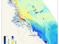
This dataset provides modelled hourly, 0.01° (~1 km) resolution NetCDF grids of surface flow rates (water flowing over land and in rivers) from 1 Jan 2007 through to 31 Dec 2023 in the catchments of the Great Barrier Reef. This dataset was generated with the Grid‑to‑Grid (G2G) distributed hydrological model configured jointly by the Bureau of Meteorology (BOM) and the UK Centre for Ecology & Hydrology (UKCEH). Flows were produced based on blended gridded rainfall and potential evapotranspiration with mapped landscape data (terrain, soils, land cover, derived river channel dimensions).

Coral recruitment patterns within and among reefs in the Cairns-Port Douglas region from 2023/2024-2024/2025 (RTP, Reef Hub, JCU TropWATER)

Published on
01 May 2026

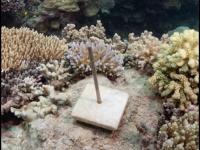
This dataset consists of two years of relative coral recruitment from within and among reefs in the Cairns-Port Douglas region from 2023 to 2025. The dataset includes one csv of the site gps coordinates where recruitment tiles were deployed during annual mass spawning periods in 2023/2024 and 2024/2025. A second csv file provides a summary of recruits recorded per tile at each site in total and, where possible, total recruits for three Scleractinia family groups or ‘Other’ where not identifiable.

Scooter Assisted Large Area Diver-based (SALAD) surveys to assess size and abundance of crown-of-thorns starfish in northern GBR (JCU)

Published on
29 April 2026

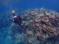
This dataset records Scooter Assisted Large Area Diver-based (SALAD) surveys of Crown of Thorns Starfish (CoTS) in the northern Great Barrier Reef from 2019 - 2025. Using scooters allows large coral reef areas to be surveyed, while allowing divers to slow down and spend more time to locate cryptic CoTS where scars on coral are visible. This dataset records the density of CoTS over the survey tracks and size measurements of individual CoTS. This dataset comprises of two inter-related tables.

Supporting datasets for estimating reef counts in the Coral Sea and northern Australia (NESP MaC 3.17, AIMS)

Published on
01 December 2025

This collection contains supporting datasets created to assist in estimating the number of reefs in the Coral Sea and northern Australia. The 'Analysis-regions' shapefile provides standardised spatial boundaries defining reporting regions across northern Australia and adjacent waters (Great Barrier Reef, Torres Strait, Coral Sea, and northern/northwestern coastal areas) used to aggregate and compare reef count statistics.

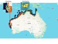
Shallow benthic and geomorphic habitat maps for Northern and Western Australia (NESP MaC 3.17, UQ, UNSW, AIMS)

Published on
28 November 2025

This dataset corresponds to high resolution (10 m) raster shallow benthic and geomorphic habitat maps for Northern and Western Australia estimated from Sentinel 2 composite imagery from 2018 – 2023. Benthic classes include sand, rubble, rock, seagrass, coral/algae, microalgal mats and light seagrass. Geomorphic classes include deep, sediment slope, shallow lagoon, deep lagoon, inner reef flat, outer reef flat, reef crest, terrestrial reef flat, sheltered reef slope, plateau, back reef slope, small reef and rocky reef.

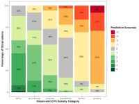
Testing and integrating CoTS connectivity matrices into ReefMod-GBR (CCIP-RT-08, UQ, JCU, and QUT)

Published on
31 October 2025

This dataset documents the evaluation and selection of crown-of-thorns starfish (CoTS) larval connectivity matrices for use in ReefMod-GBR, along with the subsequent calibration of CoTS population parameters. The project evaluated which pre-existing connectivity matrix set produces the most accurate CoTS density predictions when integrated into the model, and determined the optimal parameter values for that matrix set. Note: This metadata record is published for discovery purposes only; the dataset files are not directly available for download.

eReefs visualisation suite - pre rendered animations and maps (AIMS, Source: CSIRO)

Published on
18 October 2025

This record describes the visualisations made available through the AIMS eReefs visualisation platform (https://ereefs.aims.gov.au/). It is a collection of 88,000 pre-rendered animations and static maps of selected combinations of model variables from the eReefs hydrodynamic and biogeochemical models. Each visualisation product shows multiple related variables together to assist in understanding the dynamics that drive the marine environmental conditions on the Great Barrier Reef and Coral Sea.

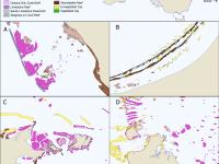
Australian Tropical Reef Features - Boundaries of coral and rocky reefs (NESP MaC 3.17, AIMS)

Published on
05 August 2025

This dataset contains a shapefile of the boundaries of more than 23,000 tropical coral reefs, rocky reefs and sand banks of tropical Australia, covering Indian Ocean, Timor Sea, Gulf of Carpentaria, Torres Strait, Great Barrier Reef and the Coral Sea. This dataset provides the first comprehensive mapping of the reefs of tropical Australia, covering intertidal rocky reefs through to offshore oceanic coral reefs. It includes all reefs shallower than approximately 10 - 30 m on the continental shelf and up to 60 m depth in oceanic waters.

North and West Australian Tropical Reef Features - Boundaries of coral reefs, rocky reefs and sand banks (NESP MaC 3.17, AIMS, Aerial Architecture)

Published on
30 July 2025

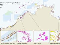
This dataset provides mapping of 11,000 shallow coral reef, rocky reef, and sand bank feature boundaries in the north and west of tropical Australia. This dataset is intended to assist with environmental accounting, marine management, marine research planning and environmental impact assessments. All features were digitised manually from satellite imagery that was optimised for image clarity of marine habitats (Hammerton & Lawrey, 2024a; Hammerton & Lawrey, 2024b).