Articles

Published on
Image
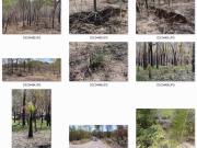
Collection of photos
The eAtlas encourages researchers to submit photos to the eAtlas to show research in action and to provide a library of photos that show environmental places, process and behaviours.
Published on
Image
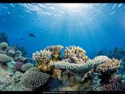
Osprey Reef
High-resolution 360-degree panoramic vision collected by Caitlin Sea Survey lets you 'swim' through reefs in the Coral Sea Marine Park.
Published on
Image
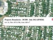
Property boundary map

You can now view the lot number, plan number and property area for any property in Queensland. Simply zoom and pan the map to the area of interest and click to get the information.
Published on
Image
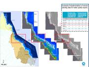
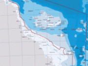
Three maps, first showing water bodies extending out from the queensland coast, second showing chlorophyll levels and third showing areas exceeding the guideline thresholds
Remote sensing is now recognised as a suitable and cost-effective technique for describing and quantifying aspects of coastal water quality of the Great Barrier Reef (GBR). As a component of Paddock to Reef (link) reporting, water quality estimates retrieved from the MODIS Aqua satellite time series are compared to regionally-specific environmental values and objectives set in 2009 for each of five water bodies identified in the Great Barrier Reef World Heritage Area (GBRWHA).
Published on
Image
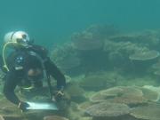
Orpheus Island surveying

Coral reefs in the coastal and inshore zones of the Great Barrier Reef are highly valued for recreation and local tourism. The proximity of these reefs to the land exposes these reefs to land runoff carrying excess amounts of fine sediments and nutrients from developed catchments. It is clear that in combination with acute disturbances such as Tropical Cyclones and high sea-water temperatures, which lead to coral bleaching events, exposure to runoff is impacting these ecosystems (scientific-consensus-statement).
Published on
Image
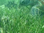
Green turtle feeding on seagrass
Seagrass are considered coastal canaries or coastal sentinels that can be monitored to detect human influences to coastal ecosystems. The inshore seagrass monitoring program was designed to detect improvements in water quality, resulting from changes in land management implemented through Reef Rescue. Data collection commenced in 1999 as part of the Seagrass-Watch program and in 2005 it was expanded and integrated as part of the Reef Rescue Marine Monitoring Program
Published on
Image
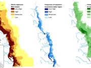
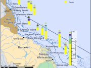
Coastal flood plume exposure in the North Queensland Wet Tropics
There is an updated version of the details of this part of the MMP monitoring program.
Published on
Image
TRaCK Logo

TRaCK (Tropical Rivers and Coastal Knowledge) is a research hub which has drawn together more than 70 of Australia's leading social, cultural, environmental and economic researchers. Our research focuses on the tropical north of Australia from Cape York to Broome.
Published on
Image
Map of pesticide and herbicide sampling sites on the Queensland coastline. Also shows the Herbicide levels for 2011.
The transport of pesticides from land-based applications to the coastal waters of Queensland is considered a potential risk to the health and heritage values of the Great Barrier Reef ecosystem. At sites near the Queensland coast pesticides and herbicides from agricultural sources have been detected throughout the year. The aim of this component of the MMP is to assess trends in the concentrations of specific herbicides and pesticides, primarily through routine monitoring at sites within 20km of the coast.
Published on
Image
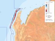
PreviewImage_bathy_ningaloo_50m.jpg
Fine scale bathymetry information is available for the Ningaloo Marine Park
Published on
Image
GBRMPA

As part of its commitment under Theme 5 of the MTSRF, the Reef and Rainforest Research Centre publishes, or makes available, outputs (e.g. final technical or scientific reports, synthesis reports) from MTSRF-funded research projects nested within Research Themes 1-4.
Published on
Image
Sheriden

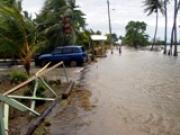
Access and download PowerPoint slides (in PDF) prepared by Jane Waterhouse, C2O Consulting, for presentation to government agencies involved in water quality management in the GBR.
Published on
Image
Coral Sea Map
This article provides a brief review of the Coral Sea, and lists the main body of literature written about this important geographic region.
Published on
Image
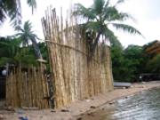
Tidal inundation on Thursday Island, Torres Strait

This report provides a synthesis of research on climate change and coastal science in the Torres Strait, and has been produced for the Australian Government’s Marine and Tropical Sciences Research Facility (MTSRF). It identifies and summarises work to date on reef evolution, hydrodynamics and sedimentary environments throughout the Torres Strait. It describes the island dynamics at Boigu, Saibai, Masig, Poruma, Warraber and Iama Islands.
Published on
Image
Torres Strait

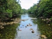
Researchers funded through the Australian Government’s Marine and Tropical Sciences Research Facility (MTSRF) have worked closely with Torres Strait communities to improve our understanding of both the vulnerability of Torres Strait islands to climate change, and their adaptation capacity.
Published on
Image
Creek Shannonhogan

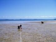
Managers of the Great Barrier Reef (GBR) require information on the status of reef ecosystems, relationships between pressures and response, and an understanding of the thresholds of GBR species and ecosystems to these pressures. This information can be used to establish guidelines and targets for management that trigger a strategic management response. Knowledge of catchment and instream ecosystems is also necessary for regionally based natural resource managers, and to refine the understanding of relationships between catchment and marine ecosystems.
Published on
Image
Monitoring

As part of its commitment under Theme 5 of the MTSRF, the Reef and Rainforest Research Centre publishes, or makes available, outputs (e.g. final technical or scientific reports, synthesis reports) from MTSRF-funded research projects nested within Research Themes 1-4.
Published on
Image
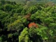
Rainforest

As part of its commitment under Theme 5 of the MTSRF, the Reef and Rainforest Research Centre publishes, or makes available, outputs (e.g. final technical or scientific reports, synthesis reports) from MTSRF-funded research projects nested within Research Themes 1-4.
Published on
Image
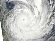
Cyclone Yasi
Severe Tropical Cyclone Yasi crossed the Queensland coast near Mission Beach on the night of the 2nd February 2011. This page shows satellite images (from NASA's MODIS satellites) of the disturbance to the Great Barrier Reef, damage to the vegetation in Mission beach and Cardwell area and flood plumes along the North Queensland coast. North Queensland Maps Click on the maps to see a high resolution version. You can download the data, imagery behind the maps in this article.
Published on
Image
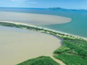
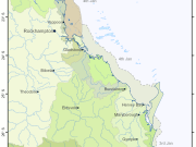
QLD Flood Plumes 2011-01-07
This page shows the extent of the flood plumes of the Fitzroy, Burnett, Mary and Brisbane Rivers caused by the extensive flooding that occurred in Queensland in December 2010 and January 2011.