Articles

Published on
Image
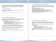
Screenshot of the first two pages of the Access Control Plan

The Sensitive Data Access Control Plan is an eAtlas form for documenting how restricted research datasets should be managed, discovered and accessed over time.

Use this form when a dataset cannot be published openly, but still needs to be described, governed and made discoverable through public metadata. The form helps project teams record why the data is sensitive, what kinds of use may be acceptable, who should be consulted about access, and how the dataset should be managed after the original project team has moved on.
Published on
Image
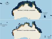
Preview map of the Sentinel 2 All-tide and Low-tide composite imagery datasets, showing that they span the tropical marine areas of Australia

This article outlines the new NESP MaC 3.17 Sentinel-2 composite imagery for tropical Australia. It explains how thousands of Sentinel 2 images were combined to create satellite imagery optimised for studying the shallow marine environments. It covers how the composites were built, how deep they reach, and how to view or download the imagery for research or management.
Published on
Image
Figure 8
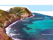
Ocean Infinity completed drone photogrammetry at seven sites representing various areas of the Norfolk Island coastline. High-resolution digital elevation models and 3D imagery were produced to analyse the geomorphology of the coastline.
Published on
Image
Picture1.png
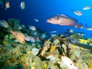
Ever wondered what the weird and wonderful inhabitants of Australia’s Marine National Parks look like?
Published on
Image
BRUV survey Tasman Fracture Marine Park 2021
A second survey of the fish, lobster and non-mobile seafloor organisms in shelf waters within the Tasman Fracture Marine Park (TFMP) was conducted in 2021, following initial surveys in 2014/15. The broad aim was to look at changes in the no-take National Park Zone (NPZ) following protection, relative to adjacent fished locations both within the park and in nearby areas. The 2021 surveys reinforced the status of the TFMP as a biodiverse Marine Park within the SE Marine Park Network.
Published on
Image
Coral reef Norfolk Marine Park
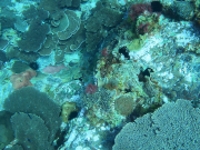
In collaboration with Norfolk Island residents, a drop-camera system was used to ground-truth the marine habitat classifications derived from satellite imagery of the ecosystems surrounding Norfolk, Nepean, and Phillip Islands. This resulted in the first marine habitat map for Norfolk Marine Park.
Published on
Image
Gorgonian and Fish Site 5_Clip2.mov_.00_00_06_52.Still002 (002).png

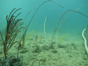
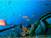
A seagrass meadow 65 km long to 9.7 m depth and extending 7–8 km from shore was discovered during benthic habitat surveys of the Limmen Marine Park and adjacent Limmen Bight Marine Park by li-Anthawirriyarra Rangers and scientists. Soft corals, hard corals and sponges also formed habitat through much of the Limmen Marine Park.
Published on
Image
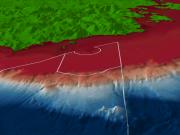
Zeehan Zoomin 3 D
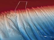
Zeehan Marine Park displays low-profile platform reef across much of the shelf area.
Published on
Image
TF Zoomin 3 D
Tasman Fracture Marine Park contains deep reefs, seamounts and a fracture zone unique to the network.
Published on
Image
STR Zoomin 3 D 2
South Tasman Rise Park contains a cluster of distinctive seamounts characterised by flat tops that potentially encompass many shelf reef habitats.
Published on
Image
Nelson Zoomin 3 D
Nelson Marine Park contains complex undersea topography, including lower-slope and abyssal ecosystems.
Published on
Image
Murray Overview 3 D 1
Murray Marine Park contains highly varied geomorphology throughout the park, potentially encompassing many shelf reef habitats.
Published on
Image
MI Zoomin 3 D
Macquarie Island Marine Park features both sanctuary and habitat protection zones offering the highest levels of protection to this unique sub-polar park.
Published on
Image
Huon Zoomin 3 D
Huon Marine Park displays multiple levels of seabed habitats from the large cluster of seamounts on the continental slope to low profile reefs and sediment plains on the continental shelf.
Published on
Image
Freycinet Zoomin 3 D
Freycinet Marine Park features sediment dominated shelf areas, a high-profile granite reef, and low profile reef ridges along the mid-shelf.
Published on
Image
Franklin Overview 3 D 1
Franklin Marine Park is dominated by shelf unvegetated sediment habitat with high-profile deep reef features in the northern section.
Published on
Image
Flinders Zoomin 3 D

Flinders Marine Park contains soft sediment and hard substrate shelf areas, canyons, deep (mesophotic) reefs, and seamounts.

Published on
Image
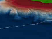
East Gippsland Overview 3 D 2
East Gippsland Marine Park contains deep water habitats featuring large box canyons, ridges, margin slumps, and plateaus bordered by steep escarpments.
Published on
Image
Boags Zoomin 3 D 1

Boags Marine Park contains extensive mobile dune fields, likely dominated by crustaceans, polychaete worms and molluscs that live in and on sediments.
Published on
Image
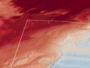
Apollo Zoomin 3 D

Apollo Marine Park contains sediment ecosystems, deep (mesophotic) reefs and a 5m high raised ridge feature, suspected to be deeper (rariphotic) reef habitat extending from the western park boundary to the northern park boundary